INTERNATIONAL FIELD SCHOOLS N-Z
[NOTE: The listings below marked in GREEN are still waiting to be updated for Summer 2026. If you are interested in a particular field school, please contact them directly for new 2026 details]
NORTH MACEDONIA
Stobi (The Capital City of Macedonia Secunda) Excavation
Dates: June 6 to July 4, 2026 Application deadline: Until places are filled, or May 6, 2026
Project website: https://www.bhfieldschool.org/program/stobi-archaeological-excavations
Project type: Field school & archaeological excavation. The variety of activities and the team’s professionalism and flexibility make this project suitable for both beginners and advanced students in the field of Roman Archaeology.
Site and venue: The Archaeological site of Stobi is near the village of Gradsko, the Republic of North Macedonia. Since 2012, Stobi has been included in the World Monuments Fund Watch list among the sites with universal significance – read more here!
The Site and the Excavation Project

 The ancient city of Stobi was the largest urban centre in the northern part of Roman Macedonia and later the capital of the province Macedonia Secunda. Its strategic position at the crossroads of the Axios valley route (Thessalonica–Stobi–
The earliest mention of Stobi comes from Livy, who refers to Stobi in four passages, one of them revealing the location at the confluence of the Axios and Erigon rivers. After the Roman conquest, the city became part of the Fourth Meris and developed into a major salt-trading centre linking Macedonia with Dardania. Stobi gained the status of oppidum civium Romanorum in the 1st century BCE and became a municipium somewhat later. A coin mint was established under Emperor Vespasian in 69 CE.
The city flourished from the 1st to the 3rd centuries CE, when its most notable monuments were built: the Theatre, the Temple of Isis and Serapis, the Synagogue, the Building with Arches, and the Casa Romana. After a major earthquake around 300 CE, Stobi was rebuilt in the early 4th century CE and became the seat of a Christian bishop who participated in the Council of Nicaea in 325 CE.
In the 5th and 6th centuries CE, Stobi served as the capital of Macedonia Secunda and one of the leading Christian centres in the Balkans. Magnificent buildings such as the Theodosian Palace, the House of Peristeria, the Episcopal Basilica with its baptistery, and the Episcopal Residence (Casino) reflect the city’s prosperity. Stobi was attacked by the Ostrogoths under Theoderic the Amal (later Theoderic the Great) in 479 CE, and another earthquake around 520 CE damaged much of the city. Despite this, life continued until the early 7th century CE, when the city was abandoned.
During the Medieval period (11th–14th centuries CE), a small settlement survived among the ruins, but Stobi eventually disappeared from record until its rediscovery in the late 19th century.
Periods of excavations:
 For more than a century, the ancient city of Stobi has been attracting scientists from all over the world to reveal its secrets. The first reported excavations were begun during World War I by German officers and the archaeologist Hald and later on Krischen;
1923 to 1940 – Excavations, directed by Balduin Saria and R. Eger, Kj. Truhelka, V. Petkovic, J. Petrovic, Dj. Mano-Zissi – the Belgrade National Museum;
1955 to 1969 – Excavations carried out by the Archaeological Museum of Skopje and the Agency for Protection of Monuments of Culture, Macedonia;
1970 to 1980 – Excavations, directed by Dj. Mano-Zissi and J. Wiseman – the Museum of Veles, Macedonia, University of Austin, Texas, and later Boston University, USA.
1992 to 1995 – rescue excavations by the Agency for Protection of Monuments of Culture, Macedonia;
The National Institution Stobi (NI Stobi) was founded in December 2008 as an independent governmental institution under the Ministry of Culture. The large-scale excavations conducted by S. Blazhevska (NI Stobi) began in 2009. Since then, until the present day, numerous archaeological and conservation projects have been successfully finalized (for more information, see: www.stobi.mk).
 Major field school topics/activities: archaeological field techniques and methods for excavation and documentation regarding the specifics of excavation of Roman and Late Roman urban sites; course on photogrammetry and 3D archaeological recording and modelling; finds processing; as well as excursions to significant heritage sites in the Republic of North Macedonia and Greece.
BHF Partners in this project:
Dig directors: Dr Silvana Blazevska (archaeologist and director of the National Institution Stobi) and Goce Pavlovski (archaeologist at the National Institution Stobi, PhD Candidate in Archaeology)
Field school coordinators: Angela Pencheva (Balkan Heritage Foundation & Field School Program Director, PhD in Classical Archaeology) & Matthew Schueller (BHF-affiliated archaeologist; visiting Asst. Prof. at William and Mary, USA); Goce Pavlovski (archaeologist, NI Stobi, PhD Candidate in Archaeology);
Academic credits available: 12 ECTS credits are available through New Bulgarian University, Bulgaria.
Visa Note: Citizens of the EU, EEA, UK, USA, Canada, Japan, Australia, and New Zealand do not need entry visas for the Republic of North Macedonia for up to 90 days. Those from countries not specified should check in advance if they require entry visas and any associated costs will be the responsibility of the participants.
Special requirements: The project is not recommended for individuals with solar allergies or other medical conditions that might be exacerbated during the intensive outdoor activities. The average summer temperatures in the area range between 25-35°C (77-95°F) or higher. All participants should bring clothes and toiletries suitable for hot and sunny weather. Bear in mind that chillier days are very rare but not uncommon.
| WATCH STUDENTS’ TESTIMONIALS! |
NORTH MACEDONIA
Workshop for Architectural Conservation of Archaeological Sites, 2026 (Northern Macedonia)
Dates: May 23 to June 5, 2026
Program website: https://www.bhfieldschool.org/program/workshop-for-architectural-conservation-of-archaeological-sites
The Site and Excavation Project
The ancient city of Stobi was the largest urban centre in the northern part of Roman Macedonia and later the capital of the province Macedonia Secunda. Its strategic position at the crossroads of the Axios valley route (Thessalonica–Stobi–
 The earliest mention of Stobi comes from Livy, who refers to Stobi in four passages, one of them revealing the location at the confluence of the Axios and Erigon rivers. After the Roman conquest, the city became part of the Fourth Meris and developed into a major salt-trading centre linking Macedonia with Dardania. Stobi gained the status ofoppidum civium Romanorumin the 1st century BCE and became amunicipiumsomewhat later. A coin mint was established under Emperor Vespasian in 69 CE.
The city flourished from the 1st to the 3rd centuries CE, when its most notable monuments were built: the Theatre, the Temple of Isis and Serapis, the Synagogue, the Building with Arches, and the Casa Romana. After a major earthquake around 300 CE, Stobi was rebuilt in the early 4th century CE and became the seat of a Christian bishop who participated in the Council of Nicaea in 325 CE.
In the 5th and 6th centuries CE, Stobi served as the capital of Macedonia Secunda and one of the leading Christian centres in the Balkans. Magnificent buildings such as the Theodosian Palace, the House of Peristeria, the Episcopal Basilica with its baptistery, and the Episcopal Residence (Casino) reflect the city’s prosperity. Stobi was attacked by the Ostrogoths under Theoderic the Amal (later Theoderic the Great) in 479 CE, and another earthquake around 520 CE damaged much of the city. Despite this, life continued until the early 7th century CE, when the city was abandoned.
During the Medieval period (11th–14th centuries CE), a small settlement survived among the ruins, but Stobi eventually disappeared from record until its rediscovery in the late 19th century.
History of Excavation and Conservation of the Theodosian Palace:
One of the most representative residential buildings in Stobi – theTheodosian Palace(1330 sq. m.) is located at the center of the city, bordered by two main streets: Via Principalis Inferior and Via Principalis Superior. The building, which is richly decorated with mosaics, was given its name by early scholars under the assumption that the emperor Theodosius I was accommodated there during his visit to Stobi in 388 CE. The residence consists of a large peristyle court with corridors and a large fountain/nymphaion, 11 rooms around the courtyard, including a large triclinium to the south and a vestibule with corridors on the east. The floors in the north and west corridors are covered with mosaic floors in opus tessellatum, the court in opus segmentatum and the triclinium is covered with sectile, while the four smaller apsidal rooms on the northwest side are covered with mosaics in opus tessellatum and opus sectile. The walls are built of sandstone and lime mortar. Most of the architectural marble is preserved in fragments and left in the courtyard.
The palace was excavated in the 1920s (1927-1929) and some test trenches were dug in the 1970s and 2014-2015. In the 1920s, the walls were protected with cement caps. In 2005-2006, conservation was carried out in the eastern part of the house, the courtyard and the north wall using cement-based mortar. Preventive conservation was carried out on the mosaic floors in the 1970s.
In 2022, the Balkan Heritage Foundation and the National Institution Stobi received a grant from theJ. M. Kaplan Fund, USA, for the conservation of the Theodosian Palace of Stobi. The British conservation company Skillington was contracted to work together with the local team. In order to support their efforts in 2025, we are launching a new field school that will provide a unique opportunity for students and volunteers to gain comprehensive knowledge and hands-on experience in the conservation of authentic archaeological structures in the ancient city of Stobi, made with Roman and Late Roman masonry.
In addition to the generous support of the J. M. Kaplan Fund, the project has received new funding in 2025 from theAmerican Institute for Roman Culture (AIRC) under its Expandere Conscientiae Lumen initiative, ensuring the continuation of the conservation of the Theodosian Palace.
Instructors, Trainers and Area Supervisors:
- Dr. David Carrington, founder and Managing Director of Skillington Workshop and an accredited Conservator-Restorer (ACR).
- Dimitar Nikolovski (archaeologist, NI Stobi)
- Stefan Stoyanov (Architect, Heritage Specialist)
The Field School
FIELD SCHOOL FOR PRESERVATION OF ARCHAEOLOGICAL REMAINS 
The field school launched in 2025 and provides a unique opportunity for students and volunteers to gain comprehensive knowledge and hands-on experience in the conservation of authentic archaeological structures in the ancient city of Stobi, made with Roman and Late Roman masonry.
During the workshop, participants will be guided through the consequent stages of study, conservation and documentation as well as the history and technology of Roman and Late Roman archaeological masonry structures.
The project includes three modules:
- practical workin documentation and both preventive and interventive conservation of archaeological structures
- lectureson history and conservation on standing archaeological structures
- as well asexcursionsto the town of Bitola, the archaeological site ofHeraclea Lyncestis,Ohrid, and Ohrid Lake(UNESCO World Heritage Site). Refer to the Course Program and Agenda
By the end of the workshop, the participants will:
- develop basic/further practical skills (depending on the participants’ initial level of qualification) in the conservation and documentation of archaeological structures
- be able to recognize the many types of pathology of archaeological masonry and their causes
- become familiar with the history and techniques of Roman masonry construction
- deepen their knowledge through a first-hand experience of Roman History, Arts and Archaeology in the region of ancient Macedonia
- meet professionals who work in the areas of conservation and Classical Archaeology.
NORTH MACEDONIA
Workshop for Conservation of Roman & Late Roman Pottery, 2026 (Northern Macedonia)
Dates: May 23 to June 5, 2026
Program website: https://www.bhfieldschool.org/program/roman-pottery-glass-conservation-course
The Workshop
 In 2026, the Workshop for Conservation and Documentation of Roman Pottery will be hosted for the 15th year by the National Institution Stobi, Republic of North Macedonia, at the Roman city of Stobi (today an archaeological park). It offers a unique opportunity for students and volunteers to gain comprehensive knowledge and hands-on experience in the conservation of Roman and Late Roman pottery. The participants are guided through the history and technology of Roman and Late Roman pottery and the consequent stages of their study, conservation, restoration, and documentation. Both the theoretical and practical parts of the course will be based on ceramic vessels found in the ancient city of Stobi.
During the first two project weeks, students begin their training with replicas of ancient vessels. Once they reach an acceptable level of skill, accuracy and precision, they can progress to originals. Most students will be able to master conservation and restoration efforts within the course of this field school and expect to complete work on 3-5 artifacts by the end of the program, depending on the initial state of objects’ conservation, the necessity of conservation treatment and the individual performance of the student.
The project includes three modules: practical work in documentation and conservation of Roman and Late Roman pottery: lectures, training and behind-the-scenes study visits and excursions to the town of Bitola, the archaeological site of Heraclea Lyncestis, Ohrid and Ohrid Lake (UNESCO World Heritage Site), and optional excursion to the ancient Macedonian capitals Pella and Vergina (UNESCO World Heritage Site), Greece as well as to a traditional pottery workshop. Refer to the Course description and Workshop agenda below.
By the end of the workshop, the participants will: 
- be able to develop basic/further practical skills (depending on the participant’s initial level of qualification) in ancient pottery conservation.
- Get acquainted with the basic methods of all the required documentation for conservation and restoration of ancient pottery, which includes drawing by hand and using graphic software, as well as photo documentation.
- learn about the forms, types and technology of Roman and Late Roman pottery.
- deepen their knowledge through first-hand experience of Roman and Late Roman History and Archaeology in the region of ancient Macedonia.
- meet professionals who work in the areas of Pottery Conservation, as well as Classical Archaeology.
Archaeological Context & Period
Why Stobi? The first historic records to mention Stobi belong to the Roman historian Titus Livy ( ca. 197 BCE). According to Livy, Stobi became an important center for salt trading after the Roman conquest of Macedonia and the establishment of Pax Romana. In 69 CE, Emperor Vespasian granted Stobi the rank of municipium and the right to mint its own coins. Stobi was not only an important salt trading center but also strategically located at the crossroads of the ancient roads that ran along the two rivers, Axios (Vardar) and Erigon (Crna). The first road connected the North and South of the Balkans as it does today, while the second to the southwest connected Stobi with the Via Egnatia near Heraclea Lyncestis (present-day Bitola) and to the northeast continued to Serdica (present-day Sofia).
This commercial and strategic position brought Stobi long-term prosperity, especially in the period between the 1st and 3rd centuries CE. Several monumental buildings in the city are dated to this period: the Theater, the first City Wall, Porta Heraclea, the Public Building with Arches (most probably the Stobi library), the Casa Romana, the Synagogue, as well as the water supply system. In 267 CE, the city suffered from raids conducted by the Goths and Herules. At the end of the 3rd century CE, Stobi was devastated by an earthquake; it was later rebuilt but following a different urban plan. Most of the ruins visible today belong to buildings dating to this period.
In the 4th century CE, Stobi became an important Christian center and the seat of powerful bishops. Late, in the 5th-6th centuries, Stobi was the capital city of the Roman province Macedonia Secunda, but suffered from the raids of Huns, Ostrogoths, Avars and Slavs. The constant threat of barbarian raids, as well as certain climatic changes, led to the gradual abandonment of the city in the second half of the 6th century CE. Some records mention a small Slavic community that settled and lived there in later centuries. The last historical reference regarding Stobi describes the victory of the Byzantine troops over Stobi’s local militia during the 11th century CE. 
The Team
Chief conservator & Field School Coordinators:
- Biljana Jankulovska Peeva, instructor, (M.A. in Inorganic Technology and Environmental protection. Specialty Characterization of archaeological pottery), BHF Affiliate, Conservator of Pottery and Glass Artefacts at National Institution Stobi (R. of N. Macedonia)
- Dr. Evelina Todorova, Department for Medieval Archaeology, National Archaeological Institute with Museum at the Bulgarian Academy of Sciences;
- Jovan Radnyanski, Archaeologist, NI Stobi;
- Dr. Angela Pencheva, Balkan Heritage Foundation & Field School Program Director;
NORTH MACEDONIA
Birth of Europe – Excavations at the Neolithic site of Amzabegovo, North Macedonia 2026 (Balkan Heritage Field School)
Dates: July 4 to August 1, 2026 Application Deadline: May 1, 2026
Project website: https://www.bhfieldschool.org/program/birth-of-europe-excavations-at-the-neolithic-site-of-amzabegovo
2025 Syllabus can be viewed at https://www.fieldsciences.org/wp-content/uploads/2024/12/Syllabus-N-Macedonia-Amzabegovo-2025.pdf
OVERVIEW
Project Type: Field School & Archaeological Excavation. This program is suitable for both beginners and advanced students, as well as anyone interested in archaeology, prehistory, and early farming communities in the Eastern Mediterranean and Europe during the Neolithic period.
Site: Amzabegovo Neolithic settlement, located near Sveti Nikole and Shtip, Republic of North Macedonia.
 Major Field School Topics/Activities: The program focuses on the archaeology of the Balkan Neolithic (c. 6400–4800 BCE). Participants will learn archaeological field techniques and methods for excavation and documentation, finds and samples processing, and surveying. Activities include lectures on topics related to the Balkan Neolithic, prehistoric Europe, data gathering and processing, interpretation and presentation of results, as well as workshops on photography, archaeological drawing, GIS, and sediment flotation. Excursions to significant heritage sites in North Macedonia are also included.
BHF Partners in This Project: Municipality Institution People’s Museum, Sveti Nikole (North Macedonia), Austrian Archaeological Institute, and New Bulgarian University (Bulgaria).
Dig director and Field School Coordinator: Dr. Darko Stojanovski, researcher at the Austrian Archaeological Institute focused on the neolithization process of the Balkans; Assistant Professor at the Goce Delchev University in Shtip; Director of several field research projects, including the long-term Amzabegovo project and the “Birth of Europe” field school program; Director of the “Neanderthal Crossroads” field school project of the Balkan Heritage portfolio between 2022 and 2023.
Research and Field School Team: Aleksandar Danev, Dr. Andrej Machkovski, Saskia Pail, Max Luger, Dejan Georgiev and Ivan Sarashov
Archaeological Context & Period
During the 7th millennium BCE, the Balkan Peninsula served as a gateway for the spread of farming, animal husbandry, and Neolithisation from Anatolia and the Near East to Europe. The central Balkan river valleys, including the Vardar and Bregalnica Valleys, were among the most significant migration routes during this period. The site of Amzabegovo, situated between these two river basins, encapsulates nearly two millennia of Neolithic development in the Balkan region. It dates from 6300 to 4800 BCE, encompassing the era from the arrival of the first farmer settlers to the advent of metallurgy.
The Site and the Excavation Project
 Amzabegovo is one of the most significant Neolithic sites in the Balkans, centrally located along the dispersal route from the Aegean to the Danube. It is not only an important archaeological site but also a key to understanding the broader patterns of human development and cultural evolution during the Neolithic era in Europe. The site features a sequence of over twenty construction phases, including residential structures, pits, economic buildings, and burial sites. In addition to Neolithic remains, the site also contains the remnants of a Roman villa.
The site first attracted scientific interest in the late 1960s when it was excavated by a joint team from UCLA (USA) and the University of Belgrade (then part of former Yugoslavia). It was established that the site is spread over more than 10 ha and r epresents the full duration and development of the Neolithic in the Balkan Peninsula. The emblematic white-painted pottery, widely represented here, was seen as a cultural mark of the Neolithic population of the Central Balkans, but at the same time, some Near Eastern elements were noted (especially in the architecture and the use of marble for the production of personal ornaments). This research positioned Amzabegovo as a reference point for Balkan Neolithic studies. After a 50-year hiatus, field research was reinitiated in 2019 through a collaboration between Dr. Darko Stojanovski, serving as Director, and the Municipal Museum of Sveti Nikole, the host institution for the project. Since 2022, partnerships have expanded to include the Austrian Archaeological Institute of the Austrian Academy of Sciences in Vienna, as well as several other European specialists. The ongoing project, titled “The First Farming and Urban Centers of Macedonia: Excavations at the Amzabegovo Neolithic Settlement,” represents an international multidisciplinary scientific collaboration. Starting in 2025, the Balkan Heritage Foundation joined the team, and the project is now hosting the “Birth of Europe” Field School Program.
 The research questions stemming from the site, with a focus on the Neolithic period, encompass a range of topics such as settlement organization, architecture, demography, economy, diet, human-animal interactions, household organization, and material culture. A key question is understanding the regional dynamics and the role of Amzabegovo as the largest settlement in the cluster of sites within the Bregalnica River basin, as well as its communication and trade routes.
This field school is an amazing opportunity to:
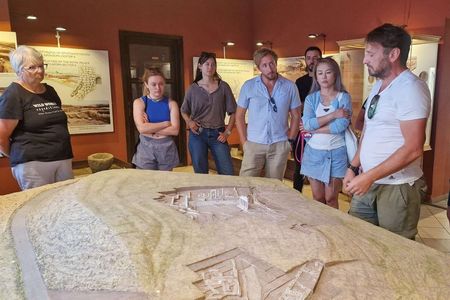
- dig at a Neolithic site in the Republic of North Macedonia
- learn about early farming societies in Europe and their technology, as well as prehistoric archaeology approaches and methods for studying material remains
- Practice all basic excavation and recording techniques in the field
- develop skills in finds retrieval and processing with a focus on Neolithic material culture
- expand knowledge on the European Neolithic and the use of interdisciplinary approaches (geology, biology, physics)
- Visit significant archaeological and historic sites, including the Roman town of Stobi, the Byzantine town of Bargala, the picturesque historic town of Kratovo, the medieval monastery of Lesnovo and the historic center of the capital city of Skopje.
The field school will continue in 2026, in conjunction with the ongoing excavations at the Amzabegovo site. This four-week field school offers a valuable opportunity for both beginners and advanced students, who will be introduced to the methodologies and theoretical knowledge necessary for participating in archaeological excavations of prehistoric sites, and for students with a deeper interest in the Neolithic studies of Europe and the Near East.
PERU
EL CAMPANARIO ARCHAEOLOGICAL PROJECT. HUARMEY – PERU (BIOARCHAEOLOGY AND ARCHAEOLOGY FIELDWORK)
Dates: June 15 to Aug 21, 2026
Project website: https://ecaphuarmey.wixsite.com/elcampanario
El Campanario Field School 2026 Information Flyer
OVERVIEW
The objectives of the El Campanario Archaeological Project in 2026 will consist of the analysis of human remains and artifacts from the cemetery, as well as the excavation of the adobe platform. Participants will learn excavation methods, mapping, profile drawing, recognizing cultural layers of occupation, identifying human remains, and recovering and identifying various archaeological materials such as pottery, stone tools, textiles, animal bones, seeds, and sea shells. During the laboratory work portion, participants will learn artifact classification, botanical analysis, pottery analysis, and textile analysis.
El Campanario Archaeological Project will offer two separate fieldwork sessions:
Bioarchaeology Session (June 15 – July 17, 2026)

The bioarchaeology session will consist of excavating the pre-Hispanic cemetery at the site of CuzCuz. Previous excavations at this site uncovered burial contexts containing various types of artifacts, such as ceramics and textiles. Students will learn excavation methods, mapping of burial contexts, recording of artifacts, identification of human remains, ceramic analysis, paleopathology, and estimations of sex, stature, and age.
Archaeology Session (July 20 – August 21, 2026)

The archaeology session will consist of the excavation of Platform 1 at the site of El Campanario. Platform 1 is a mud brick structure containing plastered walls and patios. Previous excavations at the site uncovered corridors and enclosures along with ceramics, wooden objects, and textiles. Students will learn excavation methods, mapping, recording of artifacts, material analysis (ceramic and textiles), osteology, and curation of artifacts.
Program Cost: 2.800 US dollars
What the cost includes: pickup at Lima airport, transportation from Lima to Huarmey and from Huarmey to the site, individual room with bathroom, 3 meals a day for 6 days a week (5 weeks) in Huarmey, field trip to Caral (Supe Valley), Pañamarca and Sechin. What the cost does not include: Airfare, meals while in Lima, Sunday meals in Huarmey, academic credits, travel insurance, and other personal expenses.
Living accommodations will be in the city of Huarmey, which is about a 10 minute drive to the El Campanario archaeological site. Be advised that living accommodations will be basic in that the locale will have running water and electricity; internet connectivity may not be guaranteed but there are ample internet cafes located throughout the city of Huarmey.
Contact: Dr. Jose L. Peña (Project Director)
721 S. Adanirom Judson Ave. Corona de Tucson, AZ, 85641
Email: ecaphuarmey@hotmail.com


PERU
PIARA ARCHAEOLOGICAL FIELD SCHOOL (Andean Highlands, PERU)
Dates: June 14 – July 10, 2024
Program Website:https://www.piaraperu.org/fieldschool.php
Full program details can be found here
OVERVIEW
What You Will Learn
Archaeological Research Practices. The course is an intensive learning experience that provides detailed training in a variety of important methods used in archaeological investigation.
Through both targeted training and daily practice, students will learn how to properly lay out excavation units, draw plan maps and profiles of stratigraphic and architectural features, and digitally record and visualize data using iPads in the field. Students will also attend workshops or perform labwork in GIS and 3D Photogrammetry, artifact processing, analysis, and illustration, total station mapping, and human skeletal analysis.
Students will also attend weekly lectures and discuss readings about Andean prehistory. Hualcayán is an exceptional archaeology site for learning archaeology and the Andean past because it was occupied for nearly 4000 years in prehistory. This means that students will encounter the buildings, stratigraphic layers, and artifacts for seven cultural periods and their sequential civilizations or traditions, namely Kotosh (3000–900 BC), Chavín (900–500 BC), Huarás (300 BC–AD 100), Recuay (AD 100–700), Wari (AD 700–1000), and Akillpo (AD 1000–1500, spanning both before and after being integrated into the Inka empire.
Community Collaborations. Working with the local and descendant community of Hualcayán and incorporating their needs and interests is a priority of the PIARA research project, which also makes it an important part of the student experience. Students will live in this rural Andean community and not be isolated from local people in their daily endeavors: young adults and adults from Hualcayán as well as Peruvian students from the Universidad Nacional de Ancash – Santiago Antúnez de Mayolo (Huaraz, Ancash, Peru) will work alongside us, which provides a robust intercultural learning experience. In this pursuit, students learn how to ethically and respectfully conduct research on the remains of other people’s heritage by collaborating with them as well as through targeted discussions with project and community members alike.
Beyond daily tasks, students will also contribute to heritage, education, or wellness-focused projects in the Hualcayán community. At minimum, all students will spend the equivalent of one full day (six to eight hours) working on these projects. The details of this work will depend on the community’s expressed needs and may include doing educational activities in the school, implementing projects in the community museum, cleaning up trash, painting buildings, assisting in a harvest, cataloging donated library books, or working with PIARA to prepare or host heritage-focused events.
All students will receive six credit hours from the hours from the Universidad Nacional Santiago Antúnez de Mayolo for successfully completing the course.
We invite you to explore the exciting Andean past, learn advanced archaeological methods, and experience traditional Andean culture at Hualcayán with us this summer!
How to Apply Details coming soon!


PERU
2026 Peru: Craft Production & Economic Exchange at the Sican Archaeological Complex (Bosque de Pómac)
Dates: June 21 to July 25, 2026
Project website Project syllabus Project application
Overview
Northern Peru has long been regarded as one of the primary cultural centers of the ancient Andean civilizations of South America. The more than 5,000 hectares that comprise the Pómac Forest Historical Sanctuary, a protected natural area located 31.5 km from Chiclayo, Lambayeque, Peru make up one of the most ecologically and culturally diverse locations on the planet. In the Pómac Forest Historical Sanctuary, one finds more than 20 major mounds affiliated with local pre-Hispanic groups, including Northern Gallinazo and Sicán, the world-renowned Inka, and others.
Within this fascinating cultural and ecological setting, students will experience rich multi-cultural heritage spanning over 10000 years of prehistory and take in the natural wonders of the Pacific Ocean, arid coast, and high Andes mountains. During fieldwork, students will be immersed in an interdisciplinary journey witnessing first-hand how ancient inhabitants of northern Peru survived and thrived over the last several millennia.
During the 2026 field season, you will participate in cutting-edge remote sensing surveys and targeted excavations in the Pómac sanctuary. While learning, you will help expand our understanding of ancient lifeways that shaped and were shaped by the unique characteristics of this rare ecological zone.
Instructors:
Dr. Kayeleigh Sharp, Assistant Teaching Professor in the Department of Anthropology at Northern Arizona University Kayeleigh.Sharp@nau.edu
Dr. Izumi Shimada, Distinguish Professor Emeritus, Department of Anthropology at the Southern Illinois University Carbondale
Lic. Manuel Antonio Roque Soplapuco,Faculty at the Universidad Nacional Pedro Ruíz Gallo, Peru
PERU
HUARI-ANCASH BIOARCHAEOLOGICAL RESARCH PROJECT (Proyecto Arqueológico Huari-Ancash) (Huari, PERU)
Project Dates: Season 1: June 7-28, 2026 Season 2: June 28 to July 18, 2026
Program website: https://proyectohuariancash.org/field-school
Project Syllabus for 2026 here Field School Application: click here

Welcome to our Field School!
The time of this field school is well organized so that participants engage in different aspects of the project: survey, excavation, and lab. The goal is providing the basis of archaeological work and give an overview about what means to become an archaeologist. We lecture a lot during the first few days and cover a lot of ground even for those who have no previous experience in excavation (especially working with human remains). This makes our field school a bit different perhaps; students do get a rich theoretical background before the excavations start as well as during the excavations so that theory and practice blends into a whole thus making sure the participants get connected with the work and the area and have a wholesome understanding of the research.
It is important to keep in mind and, hopefully, to look forward to, that that the project takes place in a very rural area. You may travel to Peru and never really get the taste of life in deep provincial areas which truly are a world to themselves. Huari is such a town. It is surrounded by mountains, it is deep in the mountains. Life is simple, and time passes by very differently here. There still a lot of authenticities and lots of sightseeing. People are friendly, and they love visitors, and we on our end expect the participants to respect what is new and VERY foreign to them.
Our Program
The field conditions are different than those you experience in your home or university. Archaeology in the Andes is a hard, cold, physically exhausting, dirty, and demanding activity. When deciding to work in this part of the world it is important to understand that learning to deal with very different circumstances at hand is a crucial part of participation in the project and to make the best of a given situation with the tools available. This is not a summer vacation although we promise you will have a great time. And on our end, we expect all members of our project to be patient, upbeat, flexible and prepared.
We hope you are up for the challenge to learn and discover and look forward to meeting you this coming summer.
Our field school aims to provide participants with knowledge about how archaeologists work in the field. We understand that archaeologists do not always do research (academia) and that the vast majority work in CRM (Cultural Resource Management). The field school is designed in such a way that students progressively learn each stage of archaeological work. To this end, we work at several archaeological sites with different configurations that allow them to develop skills in multiple situations.
Week 01. After you arrive, we will lecture on archaeology techniques, the historical background of the region, and the result of the previous season. Then, we survey 04 nearby archaeological sites (so you get acclimatized to the altitude). It is followed by techniques for recording and describing archaeological sites. Since all the sites have different layouts, students identify differences in architectural terms. Recording information includes photogrammetry, using a drone and camera. Besides, surface recollection, and its proper labeling. We simulate situations commonly present in CRM (Cultural Resource Management). CRM is the primary source of work opportunities; we want students to be ready for these jobs.
During the explorations, students acquire knowledge of how to set up test pit grids, either individually or aligned over several tens of meters, as well as how to fill out registration forms. Other sites allow students to gain experience in recording architecture or other elements, such as roads and canals. A total of 4 sites are explored, whose complexity and chronology vary (1000 BC – 1500 AD). One of these sites corresponds to the Incas; students will be able to hike along the Inca royal road and examine the complex architecture of this civilization.
BACKGROUND to the Huari-Ancash Bio-Archaeological Research Project
 The study of burial patterns constitutes an important component of the examination of the ancient political organization and social identity. I believe that the study of tombs and their relationship to the landscape permits a discussion of how ancient peoples perceived the dead, as well as inform archaeologists about ritual practices. Burials can shed insight on those rituals and their relationship with the political and social organization by associating the type of tombs to large-scale modifications in public and ceremonial architecture.
Our research examines how changes in mortuary patterns were associated with transformations in politicaland social organization between AD 200 and 1600. There are 4 main categories of tombs: 1) funeral caves, 2) subterranean tombs, 3) cist tombs, and 4) chullpas (above ground burial structures). By applying a diachronic approach, we study: 1) how variation in tombs is reflected in public and ceremonial architecture, 2) if changes in tombs occur contemporaneously with changes in public and ceremonial architecture, 3) if there is continuity in the use of some type of tombs, and 4) rituals associated with the dead. Particular emphasis will be placed on the examination of chullpas holding over 50 individuals. Chullpas were places where ayllu-based social organization materialized. Ayllus were social groups based on kin with a common ancestor that worshiped a huaca or a sacred mountain. They were important because ayllus controlled rights over land, water, and labor management. Combining data of mortuary and settlement patterns, we will explore the links between changes in mortuary practice and changing sociopolitical circumstances in the region.
COMPONENTS OF THE FIELD SCHOOL:
The Field School is focused on three aspects of research, and we follow different techniques in the field and lab, they are organized in such a way that students get familiarized with archaeological techniques.
Week 01. After you arrive, we will lecture on archaeology techniques, the historical background of the region, and the result of the previous season. Then, we survey 04 nearby archaeological sites (so you get acclimatized to the altitude). It is followed by techniques for recording and describing archaeological sites. Since all the sites have different layouts, students identify differences in architectural terms. Recording information includes photogrammetry, using a drone and camera. Besides, surface recollection, and its proper labeling. We simulate situations commonly present in CRM (Cultural Resource Management). CRM is the primary source of work opportunities; we want students to be ready for these jobs.
Week 02. This week is dedicated to excavation, full in camp (Monday to Saturday, 8 to 4 PM). We excavate a complex of tombs. During the excavation students get familiar with archaeological context description, identification of stratigraphy, recording, and classification of findings. This part includes drawing/mapping of funeral structures/caves, techniques of bone recovery, and identification of the taphonomy process in human remains. A physical anthropologist is present during the excavations, and lectures about human remains are done in situ as we find the remains. It is the best way to learn, since findings on terrain are different than those in the textbooks.
Week 03. It is dedicated to lab; analysis of human remains and lectures in forensic anthropology with real samples performed. The bone analysis’s goal is to obtain biological data from the remains recovered by students themselves during the current season or from previous excavations. Additionally, workshops in ceramic analysis, 3D scans of entire objects, photography, and labeling of material are performed.


POLAND
FIELD SCHOOL IN MORTUARY ARCHAEOLOGY POLAND 2024
Dates: Session I: June 24 to July 17, 2024
Session II: July 18 to August 10, 2024
Project website:http://www.slavia.org/fieldschool_new.php?go=fieldschool Request the Summer 2022 project info packet here
In the summer of 2024 we offer an intensive learning experience in human osteology and mortuary archaeology at the medieval inhumation burial grounds in Giecz and Gać. All students get involved in the fieldwork, receiving hands-on experience in the excavation of human burials and related archaeological features from their discovery to final removal. The Field School includes a strong laboratory component which provides an opportunity to practice identification of complete and fragmentary human skeletal remains.Read more
Participants will receive training in:
- Adult and Juvenile Osteology
- Human Burial Excavation
- Bioarchaeology in Practice
- Early Medieval Funerary Practices in Poland
- Archaeological Field Research Techniques
- Archaeological Material Processing and Curation
The Mortuary Archaeology Field School provides a unique opportunity for archaeology and bioarchaeology students, as well as future practitioners of forensic sciences and anyone interested in mortuary archeology, to learn recovery and documentation techniques on both archaeological and human remains. The language of the project is English. Academic credits are available.
In the summer of 2024, we offer seven weeks of bioarcheological exploration and practice at two medieval sites in Poland. The program is divided into two sessions:
- June 24 – July 17, 2024
- July 18 – August 10, 2024
The application deadline is rolling until ALL SPACES ARE FILLED. The number of places is limited.In order to get the Information Packet and the Application Formplease visithere.
Slavia is a non-profit organization dedicated to encouraging and supporting archaeological research in Poland. Through the Slavia Project we offer opportunities for volunteers and students to participate in current archaeological excavations, learn archaeological techniques, and explore details of Polish history that are yet unknown. Poland’s rich history provides a treasury of information about people, cultures, and events of the past.
Based at the Museum of the First Piasts at Lake Lednica, Poland, the Slavia Foundation carries on archaeological projects in cooperation with Adam Mickiewicz University in Poznań. We provide an opportunity for international students to gain experience in many aspects of prehistoric and medieval mortuary archaeology. A no less important goal of this project is to introduce our guests to Polish culture and history by interacting with locals and through educational tours and lectures.
The First Piasts Museum at Lednica is one of the largest open-air museums in Poland. It administers and protects Lednica and Giecz, two jewels of early Polish history (10–11 c. AD). A variety of research is conducted here in cooperation with the leading academic center of Adam Mickiewicz University in Poznań making the Museum a remarkable educational institution.
Slavia Project

 The Slavia Summer Field School in Archaeology began in 1998 in the Lednica region as a joint project of scholars from Adam Mickiewicz University, First Piasts Museum and Slavia Foundation. From the start the project was directed to international students seeking archaeological adventure in Poland. It initially offered experience in the Lednica region which included excavation of a medieval, wooden bridge abutment on Ostrów Lednicki island as well as a medieval cemetery in Dziekanowice.
In the year 2000 the project moved to Giecz starting salvage excavations at the medieval cemetery adjacent to the remains of a local, medieval stronghold. The primary focus on exploration of medieval burials and the variety of related issues in physical anthropology resulted in the new definition of the School’s specialization. The main area of instruction offered to the students have become human osteology and mortuary archaeology and the school was re-named as the International Slavia Field School In Mortuary Archaeology (also known as the „Slavia Project”). Also the team has become international joined by scholars from Ohio State University, USA.
From 2008 the Slavia Project has become responsible for rescue excavations at the endangered archaeological site of Drawsko. The archaeological works are carried out under the name of the International Slavia Field School In Mortuary Archaeology following all its procedures. This project is a joint effort of researchers from the Museum of Czarnków, Slavia Foundation, Adam Mickiewicz University, State University of New York at Oneonta and numerous international students taking part in the School activities.
For 10 years (1999-2008) Giecz Archaeological Complex has been a training ground for many international anthropology students who tirelessly mastered their practical skills in osteology and archaeology helping out at the Slavia excavations of the 12th century inhumation cemetery, commonly known as Giecz, site 4. Since then, many of these people have successfully pursued their careers in forensic sciences, bioarchaeology, or archaeology. Some of them have become university professors.
Now, the Slavia Field School in Mortuary Archaeology is pleased to invite new generations of anthropology students for a new joint effort at site 10 in Giecz. This site, which was discovered three years ago, is another inhumation cemetery and dates back to the beginning of the 11th century AD. Two pilot excavation seasons revealed 35 burials following the Christian rite, with bodies oriented east- west. The human remains feature very good preservation and include skeletons of both sexes and all age categories including newborns. Most burials have a variety of grave goods typical for western Slavs, and some are outstandingly well furnished. Among every day utensils such as iron knives, hardware fittings, and clay vessels, some graves have jewelry and decorations such as earrings, metal and glass rings, glass and carnelian bead necklaces. Some of the dead are even equipped with wooden buckets! Clearly this cemetery represents a spectrum of the local community’s social stratification. It cannot be ruled out that the richest graves belong to members of the Piast royal elite.
The Slavia Project, Mortuary Archaeology Field School in Giecz welcomes all students wishing to gain practical experience in excavating human remains and other aspects of mortuary archaeology. We are looking forward to your input in the search for yet undiscovered secrets of this site and will be happy to work with you. As the cemetery is located on an agricultural field and is subject to destructive deep plowing, your work will not only give you hands-on experience, but also the satisfaction of conserving and protecting an exceptional historical site. At the moment, the only way to preserve this unique treasure of Polish heritage is to meticulously investigate and document it. We hope you will help us to get this job done.
Contact the project for additional detailshere


PORTUGAL
NEOLITHIC LANDSCAPES OF FREIXO DO MEIO, PORTUGAL
Dates: 1st Session: March 14 – March 27, 2027 | 2nd Session: September 5 – September 18, 2027
Project details can be found here
For additional information, contact:
Filipa Araújo Santos
Conselho de administração
ARCUS – Cooperativa do Património Cultural CRL
Email: filipa.ar.santos@arcus.pt Telefone: 913 858 884
Endereço: Parque Tecnológico de Óbidos – Edifícios Centrais, Rua da Criatividade, 2510-216 Óbidos, Portugal
OVERVIEW
“Over 7,000 years ago, the first settlers arrived at Freixo do Meio, probably coming from the Tagus estuary, and sowed the very first seeds of the agro-pastoral way of life. These groups established small family-based farms, apparently organized into neighborhood communities, systematically settling in places marked by large granite outcrops.”
— Manuel Calado (Consultor Científico)
You are about to become part of a rare project in Europe, where archaeological research is intrinsically connected with other dimensions of the environment.
At Herdade do Freixo do Meio, the study of Early Neolithic remains seeks to explore the Alentejo landscape and understand the many ways humans adapted to it. The Early Neolithic was the very first moment in human history when people deliberately sought to influence the production of natural resources. Yet, throughout the millennia in which this period lasted, the use of ecosystems left only a reversible footprint, always respecting the rhythms and needs of nature. By studying these traces in depth, we can enrich scientific research and support the protection of the Alentejo landscape, inspiring more sustainable ways of living in it.
The archaeologist Manuel Calado began his work in Herdade do Freixo do Meio in 2020, launching an archaeological survey project to better understand humanity’s passage through this region. Over two years, his research uncovered an extraordinary wealth of evidence, laying the foundations for mapping and reconstructing the timeline of human occupations and movements across the Montado.
The aim now is to continue this work, broadening and deepening the excavation area, and gradually reveal new insights into the ways humans once inhabited this landscape.
If you want to know more about the Neolithic in southern Iberia:
Blog “Um lugar na pré-história“
Article “O sítio do Neolítico antigo da Valada do Mato (Portugal)“
THE TEAM
Herdade do Freixo do Meio
Herdade do Freixo do Meio is a shared-management space that has practiced organic farming since 1997, aiming to regenerate the Alentejo landscape known as the Montado.
Encompassing environmental education, nature conservation, permaculture, holistic grazing, agroforestry, and the use of alternative resources (such as acorns), and supported by various research institutions, Montado do Freixo do Meio has for decades served as a Living Laboratory of Agroecology. It has been officially recognized and strengthened with Protected Area status.
Among its core values is the mission to conserve and enhance natural resources, including biodiversity, climate, and the atmosphere, while reducing erosion and pollution of the air, soil, and water through the application of appropriate techniques; to create and preserve native livestock breeds; and to use local seeds and plant varieties whenever possible.
ARCUS
ARCUS is a co-operative of cultural management professionals, working since 2022 to innovate the ways in which historical and archaeological heritage is studied, preserved, and shared.
ARCUS combines a co-operative tradition with innovation in the field of cultural heritage. We are a team of specialists committed to the prevention, safeguarding, promotion, research, and dissemination of this shared legacy, while fostering both cultural value and the socio-economic development of our members. Our multidimensional vision embodies the essence of a multi-sector co-operative, continuously striving for innovation.
Meet the scientific directors
Filipa Santos
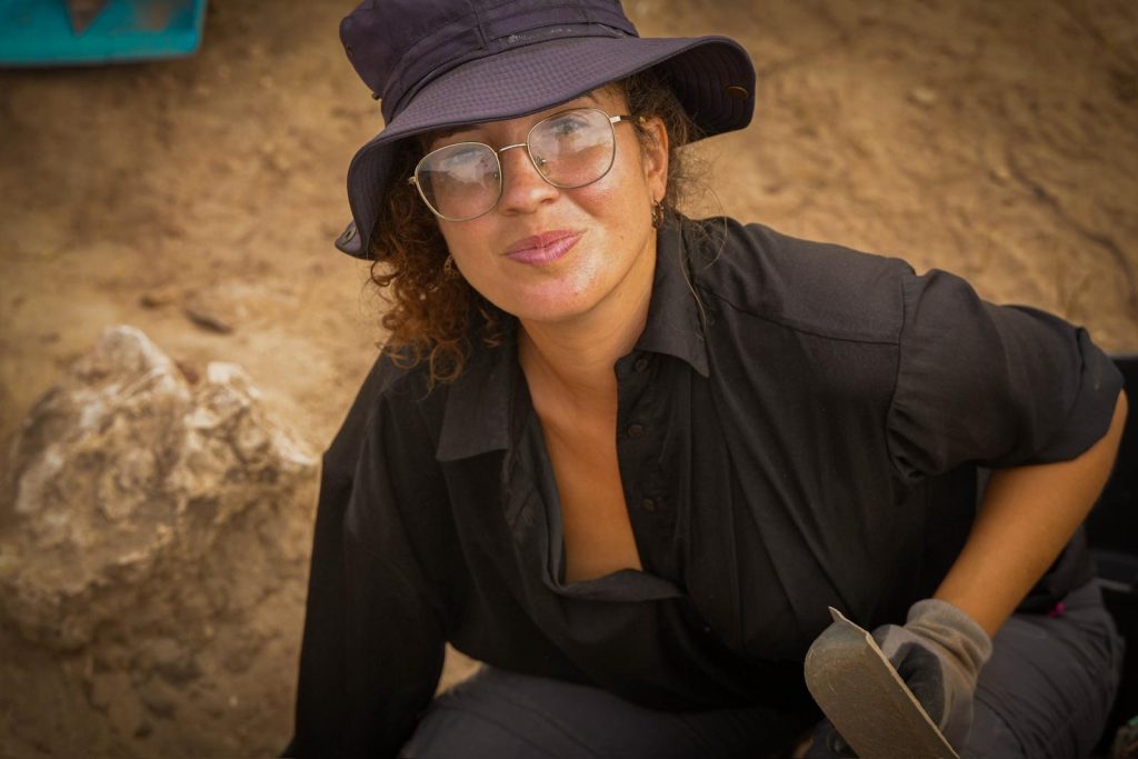
Filipa Santos has an MA in Archaeology from Lisbon University, focused on pottery. She has been dedicating her professional life to both Cultural Heritage management and Rescue archaeology in urban and rural contexts in Portugal, Spain and Mozambique.
She worked for several years in the Enhancement project of an archaeological site in Alentejo (Portugal), where the scientific research became the foundation for science communication projects and educational initiatives, partnering with schools, theaters, and local associations.
Also, she has worked in Managing Cultural Impact Studies in Mozambique. She has also participated in several digs and projects in Portugal and Spain contributing to the research of archaeological sites from Prehistory, Iron Age and historical times.
Filipa is part of ARCUS since 2023.
Nelson Almeida
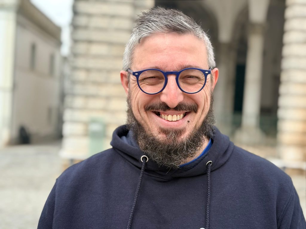
Nelson J. Almeida is an Assistant Professor at the Department of History of the University of Évora. He received his PhD in Quaternary, Materials and Cultures from the University of Trás-os-Montes e Alto Douro, in 2017. His research is focused on Iberian Late Prehistory and Protohistory and human-animal relations.
He works on Western European Late Prehistory, with research spanning archaeological fieldwork, material culture, and zooarchaeological analysis. His work explores long-term human-animal relations, combining empirical data with interpretative and relational approaches, with particular interests in subsistence, social practices, and the role of animals in past societies.
He is currently a researcher at CHAIA (Centre for Art History and Artistic Research)) and UNIARQ (Centre for Archaeology from the University of Lisbon).
Nelson has been part of the co-operative ‘O Legado da Terra’ since its founding in 2022.
Catarina Basílio
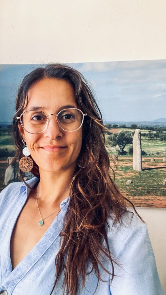
Ana Catarina Basílio is an archaeologist, researcher, and professor at the University of Évora. Currently, she works for the Municipality of Reguengos de Monsaraz, where she focuses on researching, protecting, and promoting the region’s archaeological heritage.
Her research centers on the major transformations that defined the transition between the Chalcolithic period and the early Bronze Age in southern Portugal—a topic she explored in her PhD, conducted at ICArEHB (University of Algarve), with her defense scheduled soon.
Between fieldwork, academia, and community engagement, she seeks to understand the past while finding new ways to bring it closer to people. Her work particularly emphasizes the Chalcolithic and early Bronze Age in southern Portugal, with a special focus on the Bell Beaker phase.
Catarina has been part of ARCUS since its founding in 2023.
Manuel Calado – Scientific consultant from Freixo do Meio
Manuel is a distinguished archaeologist and historian, whose career has been marked by significant contributions to the study of prehistory and archaeology in Portugal. His work is widely recognized for excavations and studies of megalithic monuments, particularly in the Alentejo region, focusing on dolmens, stone circles, and menhirs, and has significantly advanced the understanding of the prehistoric societies that inhabited the Iberian Peninsula. He holds a PhD in History and Archaeology from the University of Lisbon and is currently a guest professor at IPS and a guest professor at FBAUL.
He works with Herdade Freixo do Meio since 2020 and was responsible for the first archaeological researchs in this lands. He has been exploring experimental archaeology techniques, aiming to simulate life in a settlement over 7,000 years old in Freixo do Meio, which you will be able to visit and be part of.
PORTUGAL
CASTELO DE CUNCOS ARCHAEOLOGICAL PROJECT, PORTUGAL
Dates: May 3 to May 30, 2026 Application Deadline: April 3, 2026
Project details can be found here
OVERVIEW
Applications are now open for the eighth season of fieldwork at Castelo de Cuncos,an Iron Age/Roman Republican walled settlement located in the Central Alentejo
Castelos de Monte Novo (known locally as Castelo de Cuncos) is a large Iron Age/Roman Republican era settlement located in the Central Alentejo Portugal. So far, our work has revealed a substantial fortified settlementwhich appears to have been abruptly abandoned in the Late Roman Republican Period (1st Century BCE). Burned outer walls and the discovery of Roman weaponry during excavation suggests evidence of conflict. For the 2026 summer season we will continue excavation and hope to gain a better understanding of the site from its Iron Age origins until its likely violent end during the Roman Republican period.
Students will receive instructions in various archaeological methods such as excavation and surveying techniques, the processing and handling of artefacts, and the recording and illustrating of exposed areas. Prior experience in archaeology is not required. Both undergraduate and postgraduate students and volunteers are welcome.
Tuition for the 4-week session (including room, board, and transportation within Portugal) is $1900 USD.
(May 03 – May 30)
Tuition for the 2-week session (including room, board, and transportation within Portugal) is $1300 USD.
(May 17 – May 30)
[Some flexibility is possible within these dates, please contact us to see what is possible]
 Field School Activities
Excavation Techniques
Students will gain experience in all aspects of the archaeological process. The most obvious of which is the actual excavation of material from the ground. Students will learn proper excavation techniques using tools such as pick axes, shovels, hand axes, and trowels. Students will directly participate in digging and learn how to identify various materials such as pottery, bone, and metal fragments.
Handling and Processing Artefacts
Following the work in the field, students will take part in the cleaning and sorting of the finds from the day. Interested students may also work directly with our conservator to learn conservation techniques relating to pottery and metal objects. Depending on the volume of material to be conserved, some students will also have the opportunity to divide their time between the conservation lab and the field.
Archaeological Drawing and Recording
Apart from the actual digging itself, students will also learn how to properly record the excavation through archaeological drawings. Students will learn how to record stratigraphic layers and archaeological features and take elevation readings during the excavation.
SurveyDue to the size of the settlement, students will have the opportunity to participate in a surface survey of the area and its surrounding landscape. During the 2019 season, a metal detection survey was conducted around the settlement’s walls. Due to promising results, we plan on continuing this survey in addition to the excavation work.
Archaeological Field Trips
On the weekends, we typically visit local archaeological sites and museum throughout the Alentejo. These trips can range from visiting Roman Villas or Medieval Castles to nearby historical cities such as Evora, Beja, and Merida. These trips can be a great way to learn about some of the local history of the area, or to just lounge about and be a tourist. On some afternoons, we will also visit local sites in Redondo itself and the surrounding area.
Application Process:http://www.castelodecuncosproject.com/application.html


PORTUGAL
PORTUGAL FORENSIC ANTHROPOLOGY/BIOARCHAEOLOGY FIELD SCHOOL, SUMMER 2024
DATES: Summer 2024 (Contact the program for exact dates)
Application deadline: January 28, 2024 Application link click here
Program Website (Simon Fraser University)
Program Overview
 The Simon Fraser University Department of Archaeology is pleased to offer a lab-based field school focusing on the curation and lab analysis of human remains from archaeological and forensic contexts. Students will be traveling to three locations in Portugal for training and hands-on lab experience in the preparation, analysis and interpretation of forensic and archaeological human remains. At these locations students will have the opportunity to visit forensic and educational organizations as well as historically and culturally significant sites. The first week will be spent in the town of Gandra, nearby Porto, where students will receive basic osteological and forensic training and will visit the morgue and other forensically relevant locations. The second and third weeks will be spent at the Municipal Museum of Santarem and the University of the Algarve respectively, where they will attend labs to learn and practice various bioarchaeology lab techniques, lab processing and conservation of archaeological human remains.
Important notes:
- Information Session: Friday, January 19, 2024 at 11:30am in Saywell Hall 9152
- Application Deadline: January 28th, 2024 at 11:59pm PT
- Field School Director: Dr. Hugo Cardoso, hcardoso@sfu.ca
- An academic reference is required for this program
- Visiting Undergraduate students are welcome.
- See application instructions here.


PORTUGAL
Castelo Velho de Safara Archaeological Project (Safara, Moura, Portugal)
Project Dates: January 5 to Feb. 2, 2025
Project website: http://www.swarchaeologydigs.com/cvs.html
Castelo Velho de Safara is located in the south of Portugal, at the confluence of the river Ardila and the stream of Safareja. Positioned on a hilltop in a commanding position, it was designed with defensive walls and three ditches.
Despite being known to archaeologists since the 1940s, the first systematic excavations in Castelo Velho de Safara started in June 2018. Based on surface pottery evidence and material recovered from recent excavations, the site was dated from the Chalcolithic (3rd millennium BC), to the Late Iron Age (4th century BC), and the Roman Republican Period (1st century BC). Thus far, excavations have exposed a street running parallel to the defensive wall. The latter has some orthogonal compartmental structures associated to its interior whose function is still uncertain, but it is most probably related to storage activities. On the opposite side of the street, a longitudinal structure was identified. It is better constructed and seems to be associated with a residential area. The residential area could be divided according to status, and evidence of metal working on site is confirmed. Castelo Velho de Safara might have served as a trading post with important connections to the nearby mines of copper and silver, and with manufactured products from the Eastern Mediterranean.
Field School
On site
No previous archaeology experience is required, as students will be taught about excavation methods and techniques used on site. Teaching methods will be hands-on exercises with experienced professionals instructing on a variety of topics including site safety, setting up the excavation, heavy digging and correct use of different tools (eg. pickaxe, shovel, brush), trowelling, context recording, planning, section drawing, construction of Harris Matrices, treatment of finds and environmental sampling. These skills will be taught within the process of the research dig and students are expected to participate in all aspects of the excavation process.
In the lab
All finds and environmental samples recovered from the excavation are processed each day in the field lab. Students will be taught about how to wash them correctly, sort and label finds, including ceramics, bones, seeds, metals, glass and charcoal. The most significant ceramic finds will be illustrated. Students might also be involved in a floatation programme, from sampling on site to sample processing in the lab.
Lectures and field trips
Brief lectures will be presented every week on topics relevant to the excavation. They are aimed to combine the practical experience on site with the theoretical background. Lectures are generally related with excavation and site recording methods, survey, ceramic analysis, archaeological illustration, zooarchaeology and geoarchaeology. Lecture topics might change according to lecturers’ availability.
Field trips will be carried out in neighbouring towns, such as Moura, Mourão, Monsaraz, Serpa, Barrancos, also focusing on eventual nearby archaeological sites being excavated during our visit. Sandwich lunches must be prepared and brought from home for the field trips.
The first Saturday is free, and a common choice amongst the students is visiting the nearby town – Moura. No meals are provided on free days, but breakfast.
PORTUGAL
PORTO DA LAMA ARCHAEOLOGICAL PROJECT (Alcacer do Sal, Portugal)
Project dates: April 4 to April 18, 2025
Project website: http://www.swarchaeologydigs.com/pdl.html
This site has already been featured in a documentary now screening in several European film competitions. You can watch the trailer here: https://youtu.be/sy07cH4Jz5I
Located in central Portugal, near the Atlantic Ocean, the Roman villa of Porto da Lama maintained a close connection with one of ancient Lusitania’s most significant cities, Salacia. Linked by the Sítimos stream, which likely served as a channel for cultural exchange and influence, this strategically situated villa revealed at least three remarkable mosaics adorned with mythological and maritime themes at the heart of its domus, or landowner’s residence.
Though initially identified in the late 1940s, the site underwent partial excavation only in the emergency context of Spring 2023. This excavation uncovered the social section of a domus, featuring a foyer (vestibulum), an entrance hall (atrium), a dining room (triclinium) and the master’s study (tablinum).
Several structures and surface artefacts extend over an area exceeding 10,000 m². Our objective for the excavation season in the Spring of 2025 is to fully investigate the architecture of this affluent Roman residence and its closest dependencies.
ROMANIA
LIFE BY THE IMPERIAL ROADS: IDENTITY AND WEALTH ON THE ROMAN FRONTIER. ROMAN VILLA AND SETTLEMENT EXCAVATION, SUMMER 2024 (Rapoltu Mare, Hunedoara County, Transylvania, ROMANIA)
Dates: June 9 to August 3, 2024 (Session 1: June 9 to July 6, 2024; Session 2: July 7 to August 3, 2024)
Website:https://www.archaeotek-archaeology.org/roman-villa-excavation
Detailed syllabus from 2023 season
Application Form:https://www.archaeotek-archaeology.org/application-excavation-and-photogrammetry
OVERVIEW
The Roman conquest of Dacia, the last Imperial expansion in Europe, began in 87AD with the relatively disastrous campaigns led by Domitian and ended with Trajan’s Dacian Wars of 101/2 and 106AD. The plethora of wealth and resources the Roman Empire harnessed in Dacia (especially in Transylvania) contributed significantly to the “solvability” of the imperial economy until the Aurelian Retreat of 270AD, the funding of the construction of Trajan’s Forum in Rome being a very concrete illustration of the potential of the new province.
The mechanisms of Roman occupation of Dacia are very complex and not well understood. The Dacian aristocracy and upper classes were in continuous contact with the Roman world well prior to the final fall of the Dacian Kingdoms. These interactions took many forms, ranging from raids and limited warfare, to intensive and extensive trade, to use of Roman techniques, technologies and craftsmen.
With the defeat and “suicide” of the last Dacian King, Decebalus, in 106AD, the structures of the local social system collapsed in parts or in whole. The new Roman presence generated a dynamic and continuous process of creolization in the new province, redefining the concepts and practices of identity, wealth and class representation along Roman traditions, in theory.

However, the realities in the field are quite more subtle. First of all, the local population was still present, controlling if not the resources proper, the various technical aspects of harvesting them. Second, the new Roman population was a very diverse aggregate of ethnic groups from across the Empire, the heavy Syrian presence in Sarmizegetusa Ulpia Traiana and the many auxiliary garrisons along the various Transylvanian limes illustrating emphatically this aspect. Third, the Dacian Province presented de facto a frontier environment, constantly under pressure from foreign incursions from Germanic tribes from the north and west and the free Dacians and the Sarmatians/Scythian riders from the east.
This liminal environment generated very dynamic vectors of creolization and associated practices of identity construction. The Roman “civilizing” social constructs, based on an urbanized way of life implementing processes of alienation through technical and technological dependencies, was constantly threatened by external and internal pressures. The very rapid process of urbanization of the Dacian Provinces forced a lot of dynamic negotiation and practical creolization in the definition, construction and display of social identity and status.
This particular excavation will attempt to address these aspects of identity perception, presentation and representation. Our site is situated half way between Sarmizegetusa Ulpia Traiana and Apulum, the two most important cities of the Dacian Provinces, very close to the largest gold deposits in Europe in the Apuseni Mountains, and on the main Imperial road in Dacia. Our ground penetrating radar (GPR) survey from 2015 and 2016 has revealed a rural villa of “palatial” size, unique in the Dacian Provinces, covering ca. 0.7ha of built space. Our test excavations have unearthed a rich environment, with 2 story buildings, painted walls, potential colonnades, several buildings outside the villa complex itself and a plethora of artifacts.
We have started in 2014 the systematic excavation of the gate complex as well as surveying the region around the villa itself, and in 2016 the intensive excavation of the villa’s main building, with spectacular results. In 2020, COVID-19 slowed us down significantly, but we still managed to answer some interesting questions as we uncovered the hypocaust location in the central building of the villa, the access road to the main gate, as well as what appears to be the cemetery of the earliest village of Rapoltu Mare. In 2021, after a gap year due to Covid-19, we got back in the field and had an amazing excavation year! We have discovered a wooden floor in situ in one of the earliest buildings of the villa, which we partially explored in 2022. In 2022, we uncovered a brand new building and what looks like a bone workshop. In 2023, we will continue excavating and uncovering the wooden floor, looking for the identity of the first occupants of our villa, as well as continue all vectors of research and expand our exploration of the villa’s internal arrangements.
Combined with a series of lectures covering Daco-Roman history and archaeology, material culture analysis, photogrammetry and associated hands-on laboratory and field training, this extraordinary environment and its associated monuments, with extraordinary surrounding natural landscapes and beautiful Transylvanian churches and castles, guarantees all students and volunteers with an incredible archaeological and cultural experience.
To achieve a more encompassing archaeological field experience, we encourage all our participants to consider ourMedieval Cemetery Funerary Excavationas well, for a total of 8 weeks in the field.
Scientific Directors: Dr. Andre Gonciar (archaeology@archaeotek.org) Dr. Marius Barbu (Museum of Dacian and Roman Civilization, Hunedoara, RO)
Field Directors: Dr. William Henry (ArchaeoTek) and John P. Chamness (ArchaeoTek)
Trench Director: Dr. Jamie Bone (ArchaeoTek)
Contact: Dr. Andre Gonciar (Director – ArchaeoTek / BioArch Canada) at archaeology@archaeotek.org
Web Site: https://www.archaeotek-archaeology.org/roman-villa-excavation
Application Form: https://www.archaeotek-archaeology.org/application-excavation-and-photogrammetry

ROMANIA
Rivulus Dominarum Bioarchaeology Field School in Baia Mare, Romania
Dates: July 6 to August 3, 2024
Website: https://rivulusdominarum.com/
Application Form: https://rivulusdominarum.com/Identity/Account/Register
The 14th-17th century Piaţa Cetăţii cemetery was excavated between 2012 and 2014, resulting in the exhumation of approximately 800-1200 human burials. This was a salvage excavation, necessitated by an EU-funded redesign of the town’s historical center. As a participant in Rivulus Dominarum Bioarchaeology’s 2023 Transylvanian Laboratory Project, you will play an essential role in the preliminary analysis of the Piaţa Cetăţii skeletal collection, and will learn invaluable skills in osteological preparation and analysis directly from the project’s primary investigators.
The Goal of Rivulus Dominarum Bioarchaeology’s 2024 Transylvanian Laboratory Project
- Clean the human remains and prepare them for study
- Formulate biological profiles for the 800-1200 individual burials at Piaţa Cetăţii
- Increase legibility in Complex 66, a mass grave with indications of perimortem trauma
 The first objective is what makes the project such a unique opportunity for its students. While you will not be excavating human remains, you will begin your work on the Piaţa Cetăţii collection at precisely the point at which excavation ceased. While most human remains in teaching laboratories have already been prepped and curated, the Piaţa Cetăţii collection is untouched. Rivulus Dominarum Bioarchaeology will teach you how to properly clean and prepare human osteological material for study. This skill-set, which is rarely developed by students outside of advanced graduate work, will familiarize you with bioarchaeological laboratory standards from the ground up.
Once the burials are cleaned and prepped for study, you will formulate biological profiles. These estimations of age-at-death, sex, and pathology are the building blocks of bioarchaeological research. You will gain experience formulating these profiles for both well-preserved skeletons and skeletons in the more fragmentary state that is typically encountered in the field. This advanced training will situate Rivulus Dominarum Bioarchaeology students in extremely competitive positions for future employment in conservation or museum studies, and graduate work in archaeology, bioarchaeology, or other field sciences.
As a participant of Rivulus Dominarum Bioarchaeology’s 2023 Transylvanian Laboratory Project, you will receive graduate-level training in Bioarchaeological, Forensic, and Archaeological theory and methods, including new and innovative multidisciplinary research frameworks that are rarely taught in other field learning programs. You will learn:
- Theories of Mass Grave Formation
- Violence Theory
- Black Feminist Archaeology
- Queer Theory
- Decolonizing Bioarchaeology
- Bioarchaeological Storytelling
- Osteological Cleaning & Prep
- Fragment ID & Siding
- Skeletal Recording
- Age-at-Death & Sex Estimation
- Paleopathology & Skeletal Trauma
- Analysis of Commingled Remains


Rivulus Dominarum is a town of many names. When the people represented by the Piaţa Cetăţii skeletal collection called it home, the town was known as Rivulus Dominarum, which is where our project gets its name. Between the 19th century and the end of World War I, the town was known by the Hungarian name of Nagybanya. Following the end of the war and the dissolution of the Austro-Hungarian Empire, the town, along with most of Transylvania became officially part of the Kingdom of Romania. Despite reverting back to Hungarian control briefly during World War II, Transylvania remains Romanian and Rivulus Dominarum is now known by the Romanian name of Baia Mare, or “Big Mine”.
Maramureș county, where contemporary Baia Mare is located, was the metallurgical epicenter of Transylvania for almost 3,000 years. During the medieval era, Rivulus Dominarum was one of the most important Transylvanian mining towns in the Kingdom of Hungary, enjoying special privileges and social freedoms denied non-mining towns. With its long and continuous history of gold mining, the town represents an incredible opportunity to study the impact of mining and its biosocial consequences.
The analysis of the Piaţa Cetăţii skeletal collection, which you will play an instrumental part in formulating, is just one aspect of what promises to be a lengthy list of future research projects in Baia Mare. Very few bioarchaeological studies of mining exist, and fewer still that consider the biosocial role that mining played in mortality, community health, and social identity both inside and outside of the mines. Rivulus Dominarum Bioarchaeology places the embodiment of mining and its biosocial consequences within the larger community at the epicenter of our project; for this reason, we will not be attempting to determine who did and did not work directly in the mines. Mining will instead be studied as it would have been experienced by the individuals represented by the Piaţa Cetăţii skeletal collection: as a phenomenon that would have impacted the biological and social lives of all the inhabitants of the mining town, in one form or another. These impacts would have included not only injury or death in the mines, but also illnesses contracted through contaminated drinking water, congenital disorders resulting from maternal exposure to heavy metals, or injuries sustained through domestic abuse in mining households. Each of these biological consequences would have created social ramifications that would have reverberated throughout the entire community of Rivulus Dominarum.
As a participant in Rivulus Dominarum Bioarchaeology’s 2023 Transylvanian Laboratory Project, you will create biological profiles of the Piaţa Cetăţii skeletal collection. These estimates of sex and age-at-death, along with inventories of paleopathology and skeletal trauma endured by each individual, will shed light on who was experiencing the biological consequences of mining and what the social ramifications of those consequences were within the larger community of 14th-17th century Rivulus Dominarum.
ROMANIA
LOST CHURCHES PROJECT–MEDIEVAL FUNERARY EXCAVATION: LIVING AND DYING ON THE EDGE OF EUROPE
(Valeni, Hatghita County, Transylvania, ROMANIA) – 2024
Date: Session 1: June 9 to July 6, 2024
Session 2: July 7 to August 3, 2024
Full project details can be found here and a detailed syllabus here
OVERVIEW
As Europe redefines itself in the wake of the Ottoman invasion, the Carpathian frontier still holds fast against the Eastern invaders. Although Transylvanian suzerainty has passed from the Hungarian Kingdom, to the Ottomans, to the Habsburgs from the 15-17th century, its territory has never been invaded by the Turkish troops. However, the local populations lived under constant social, political, economic and religious stress. Since the Neolithic, Transylvania has been at the crossroads of European identity. During the late Middle Ages, this region goes not only through major political changes, but also through a spirituality crisis, under the pressure of Islam from the East and Protestantism from the West.
During the 18th century, several churches around Odorheiu Secuiesc have been abandoned. What is even more interesting is that those churches were removed from collective memory as well. Not only the written records pertaining to these churches were lost, but the local communities forgot about their existence.
Our excavation aims at retrieving the memory of these churches and to try to elucidate the social, political and religious context that created such an environment that would extract a church from local collective memory.

The Lost Churches Project started in 2013, with the excavation of two of these churches and associated cemeteries: Bradesti and Lueta. Concurrently, our osteology team has uncovered a very strange phenomenon within another church, at Teleac: 69 out of 70 burials were juveniles, with 49 preterm or fetal age, all of which dated to the 17th century.
In 2014, we have started exploring the environment that created this very unique skeletal assemblage, with the excavation of Teleac’ sister church in Valeni, with outstanding results We have discovered the building phases of the ecclesiastic buildings and their relationship to the deceased. Two of theses phases, an early medieval and a Gothic one have been uncovered, but the stratigraphy indicates that there is an even earlier church that we have been identified. The most surprising result of our 2014 campaign is the presence of what appears to be a migration period, pre-Christian tumulus under the church, as indicated by the burial of a horse associated with several individuals buried in fetal position.
Participants enrolled in this program will also have an opportunity to work with commingled human remains. Excavations at the Lost Church of Valeni during summer 2017 revealed an almost intact, stone built, medieval ossuary with excellent preservation, which we completed excavating in 2023.
Our excavation will deploy a bioarchaeological field approach. Within this context, we will concentrate our work on the individuals themselves and their immediate surroundings (i.e. clothing implements, jewelry, coffin and other primary funerary depositions). During one session of the excavation, we expect each participant to fully excavate approximately 2 individuals. Primary processing of the excavated remains, together with various lectures will provide our participants with the necessary training in human anatomy and morphology to be able to fully take advantage of the field experience.
To further expand their skills, several other projects are available to all our participants in osteology and bioarchaeology, as intensive laboratory research programs, respectively:
Adult Osteology Research Workshop
Juvenile Osteology Research Workshop
ROMANIA
JUVENILE OSTEOLOGY RESEARCH LABORATORY WORKSHOP (Bioarchaeology of Children): MEDIEVAL CRISIS POPULATIONS: VICTIMS OF CHANGE (Odorheiu Secuiesc, Harghita County, Transylvania, Romania)
Date: July 7 to August 3, 2024
Program details can be found here Application form: https://www.archaeotek-archaeology.org/application-bioarchaeology
OVERVIEW
Our Juvenile Osteology Research Workshop is a more advanced continuation of the Adult Osteology Workshop. The aim of this workshop is to provide participants with an intensive review of juvenile osteology and an overview of the ways in which this kind of unique information is interpreted by bioarchaeologists. During the workshop, participants will have the chance to study the growth and development of the human skeleton across various juvenile age cohorts, ranging from pre-natal to pre-adult. Most importantly, participants will have the opportunity to gain hands on experience with the analysis of exceptionally well preserved juvenile skeletal remains.
The aim of this project is to evaluate to what extent and how the major political events of the 16th and 17th centuries have impacted physically local populations, especially the children. During the 2013 season of our Osteology Workshops we uncovered a very interesting and unique phenomenon: during the 17th century, the inside of some of the churches in the region of Odorheiu Secuiesc, in the heart of Transylvania (Romania), was dedicated to infant burials. Our initial study of the church in Teleac/Telekfakva showed one adult, 69 juveniles out of which 48 were of preterm or fetal age.
During the next stage of the project, started in 2014, we started to address how the health of the children in the various cohorts, ranging from preterm to pre-adult, varies in this period of crisis. The very good preservation of the medieval osteological material and the high quality of the recovery during excavation provides a unique opportunity for a very intensive hands-on experience while working with juvenile osteological remains. This laboratory workshop session is intended for students with some previous osteological experience. Knowledge, both theoretical and practical, of the human anatomy and morphology is highly recommended.
In addition to hands-on laboratory instruction, participants will also contribute to numerous seminar discussions and hear lectures on topics related to the bioarchaeology of children. The workshop comprises daily intensive lectures on infant anatomy and pathology, group discussions, laboratory work, bone restoration and analysis, leading to individual and group research projects and presentations as part of the Eleventh International Osteology and Bioarchaeology Student Colloquium in Odorheiu Secuiesc. Topical areas to be included involve the following subject areas: an overview of the bioarchaeology of children, growth and development, weaning and dietary stress, juvenile trauma and pathology, and reconstruction and interpretation of infant mortality. Moreover, seminars and lectures will introduce how novel technological applications (i.e., histology, CT imaging) have been utilized by bioarchaeologists who study juvenile remains.
Students who wish to expand their skills and experience in the field can register for an additional 4 week session of the Medieval Cemetery Funerary Excavation, immediately preceding the Juvenile Osteology Workshop. Note that previous experience in human anatomy and osteology, such as our Adult Osteology Research Laboratory Workshop or equivalent, is recommended but not mandatory.
Academic Credit (optional): 3 or 6 undergraduate (graduate – if applicable) credits can be earned through University of South Florida – additional USF tuition fees apply. See USF Program Brochure for more information. USF procedures and deadlines apply. Contact Dr. Jonathan Bethard at USF for more details.
Project Director: Prof. Jonathan Bethard, Dept. of Anthropology, University of South Florida (e-mail jbethard@usf.edu)
This field school is one of several operated in collaboration with ArchaeoTekarchaeology@archaeotek.org


ROMANIA
SÂNPETRU BIOARCHAEOLOGY FIELD SCHOOL: UNEARTHING THE MEDIEVAL PAST OF TRANSYLVANIA, ROMANIA
Dates: July 7 to August 3, 2024 Click here for project syllabus with full details
FIELD SCHOOL DIRECTOR(S)
Dr. Annamaria Diana, Bioarchaeologist/Independent Researcher (annamaria.diana@outlook.com)
Dr. Daniela Marcu Istrate, Institute of Archaeology ‘V. Pârvan’, Bucharest (dmarcuistrate@gmail.com)
For a detailed 2024 program syllabus, click here
OVERVIEW
The field school takes place in the quaint village of Sânpetru, located a few km north of Braşov, in southeast Transylvania (historical region of Romania), and is part of the broader Braşov Bioarchaeology Project, established in 2014 after rescue excavations in the centre of Braşov exposed a large medieval cemetery and associated medieval and post-medieval structures. Our team has since explored the history and development of Braşov and environs through the analysis of archaeological and bioarchaeological evidence.
Located in the heart of the Carpathians and founded in the 12th century by Central European colonists (generally referred to as Saxons), invited as settlers by the Hungarian king Géza II, the city of Braşov (called Kronstadt/Corona in medieval times) was a crossroads during the Middle Ages for travelers, merchants and diplomats from central Europe and the Middle East, where communities from various ancestral backgrounds coexisted. Such a multi-cultural reality, still poorly understood, was the result of centuries of population movement across Transylvania. From pre-Roman times to the Middle Ages, the fertile Transylvanian lands were traversed and pillaged by nomadic tribes, colonised by European settlers, or disputed and conquered by more powerful entities. The Saxon cities of Transylvania (Braşov, Sibiu, Sighişoara, to name a few), are emblematic of the persistence of this historical heritage.
 The Sânpetru Bioarchaeology Field School combines training in both bioarchaeological analysis and archaeological fieldwork, and in 2024 aims to achieve two crucial research objectives:
1) The post-excavation processing (cleaning and drying) and organization (anatomical sorting and preparation for storage) of human skeletal remains from the Braşov medieval parish church cemetery, an extremely interesting site not only for its complex stratigraphy and abundance of finds, but also because of its uninterrupted use by the wealthy and upper echelons of Braşov society for over five centuries, between the 12th and the 18th century AD. This was rare for Transylvanian cemeteries, the use of which was discontinued after the Reformation. Students will be able to learn new skills, both practical and theoretical, by working with skeletal materials from single, multiple and commingled burials.
2) To continue exploring the history and origin of the fortified Saxon church of Sânpetru, a village known for this religious building and for its 14th century painted chapel. During the 2023 season, two trenches (S.18 and S.19) relative to the outer fortified walls were excavated. Students were able to expose and retrieve an articulated calf skeleton, evidence of wall collapse, and a very interesting arched structure, together with pottery sherds from diverse historical periods, and scattered animal and human bones.
The 2024 excavations in Sânpetru will also aim to:
● Further our knowledge of the structural remnants discovered in the 2023 season;
● Continue investigating the origins and development of the settlement, which was donated to the Order of the Cistercians in 1240 AD;
● Clarify the relationship between the 13th century fortified structures and the religious buildings with them associated.
Students will also be able to witness the ongoing process of conservation and restoration of the church and associated fortified enclosures and to participate in cultural heritage activities. This is a unique opportunity which will allow students to experience the importance of interdisciplinary projects and discover how the combined efforts of researchers from diverse fields of study can answer compelling research questions and bring back to life sites rich in culture and heritage.
ACADEMIC CREDIT UNITS & TRANSCRIPTS
Credit Units: Attending students will be awarded 6 semester credit units (equivalent to 9 quarter credit units) through our academic partner, Connecticut College. Connecticut College is a highly ranked liberal arts institution with a deep commitment to undergraduate education. Students will receive a letter grade for attending this field school (see assessment, below). This field school provides a minimum of 270 hours of experiential education. Students are encouraged to discuss the transferability of credit units with faculty and registrars at their home institution prior to attending this field school.


SPAIN
Sanisera Archaeology Institute Archaeological Field Schools in Menorca, Murcia, and Andalusia, Spain
Dates of the 2027 sessions:
006 Dig in the Roman City of Sanisera (Menorca · 16-day sessions, 1 May – 27 October 2027)
008 Digging Anthropology in the Sanisera Necropolis (Menorca · 16-day sessions, 1 May – 27 October 2027)
010 Digging Remains and Biological Anthropology in Sanisera (Menorca · 16-day sessions, 1 May – 27 Oct 2027)
018 Advanced Osteological Analysis in the Roman Necropolis of Sanisera (Menorca · 16-day sessions, 12 April – 21 September 2027)
050 GIS, AutoCAD and Digital Illustration in Archaeology (Murcia · 12-day sessions, 15 June – 10 July 2027)
053 Bioarchaeological Fieldwork in the Underground Funerary Crypt of San Mateo Church (Jerez de la Frontera · 12-day sessions, 3 May – 29 October 2027). Note that this is the first archaeological intervention carried out in that crypt.

Program Website: https://archaeology.institute/ and https://archaeology.institute/sanisera-archaeology-institute-courses.asp
Introductory video on the Sanisera Field School
PROJECT OVERVIEW
Sanisera Archaeology Institute, founded in 1996, runs English-language archaeological field schools in Menorca, Murcia and Andalusia, Spain. Students excavate the Roman port city of Sanisera, occupied from the second century BC to the eighth century AD, and its associated necropoleis, or take part in the bioarchaeological excavation of a seventeenth-century funerary crypt in Jerez de la Frontera. Courses cover stratigraphic excavation, Roman material culture, physical anthropology, advanced human osteology, and GIS and archaeological illustration. No previous fieldwork experience is required; the minimum age is 18. Certificates are transferable as university credit, and the programmes are listed in the AIA Archaeological Fieldwork Opportunities Bulletin.
For additional information, contact:
Fernando Contreras Rodrigo
Director, Sanisera Archaeology Institute
info@archaeology.institute · archaeology.institute
Camí de Sa Cavalleria (Fornells) · 07740 Es Mercadal · Menorca, Spain


SPAIN
Forensic Archaeology at the Church Crypts of Chelva (Spain)
Dates: Session May 31 to June 27, 2026
Project website: https://anthroctr.org/program/2026-spain-forensic-archaeology/
Project syllabus can be found at https://anthroctr.org/wp-content/uploads/2025/10/Syllabus-Spain-Forensic-2026.pdf
PROGRAM OVERVIEW:
Across time and space, many ancient civilizations bury their dead in collective, mass graves. This create highly complex burial grounds where numerous human remains and associated artifacts are mixed together. The excavation, documentation and interpretation of such sites is highly complex, and this field school focuses on training students to study such sites.
This field school takes place at the site of the Medieval Monastery of Chelva, established in 1390 CE. According to written records. the Viscounts of Chelva – important leaders of the Iberian period – were buried under the alter of the church (likely between 1551-1558 CE). Excavations within the church in 2025 revealed two large burial chambers, each containing remains of multiple humans and artifacts. We will continue the excavation and analysis of materials – both human remains and artifacts – during this program.
This field school has two parts. For the initial two weeks, students will excavate the two burial chambers, carefully documenting stratigraphy and spatial relationships between the many human remains & artifacts. For the latter two weeks, students will work at a lab, carefully studying and documenting recovered human remains, carrying out the inventory and cataloguing of artifacts recovered from the burial cists. Students will learn how to identify each bone, to determine age, gender, possible cause of death and a range of other indicators within the forensic archaeology framework.
COURSE OBJECTIVES Our program is designed to train students and professionals. Experience from this program may benefit individuals interested in forensic anthropology, forensic archaeology and bioarchaeology. While some experience working with human remains will be helpful, beginners are welcome. The first two days of the program will focus on training in ethics, international field and laboratory work protocols in forensic anthropology, human rights and their legal context in conflicts. Each student will be trained in the techniques of forensic anthropology methods. The two main objectives of this training are: a. To develop and extend skills in the identification and analysis of skeletal human remains. b. To provide the theoretical and practical knowledge to study and investigate real cases and produce scientific and technical reports.
This field school is aimed to be practical and applied. Two weeks will be dedicated to field excavation of the human remains inside crypt of the Franciscan Church in Chelva, and two weeks analysing human remains in the lab. The field and laboratory work will be complemented with workshops and visits to museums and sites and lessons focused on field work, exhumation, and post-excavation work. Each student will be assigned the remains of a single individual (both inhumed and cremated), which they will have to document for the entire process. Students will have the guidance, assistance and help of staff members at all times. A seminar will be held each Friday afternoon, where we will discuss work completed during the week, methods, findings and questions. Saturdays and Wednesdays are dedicated to excursions to important archaeological and cultural sites in the area. Sundays are rest & recuperating days.
OSTEOLOGY AND HUMAN ANATOMY ❖ Identification of human skeletal remains ❖ Morphology and variation of the skull ❖ Human muscle-skeletal anatomy ❖ Identification of the immature skeleton, individual bones. ❖ Identification and study of cremated bones. Quantitative and analytical methods ❖ Osteometry and anthropometry Application of methods, measurements and instruments. Quantification and comparison. Use of standards
BIOLOGICAL ANTHROPOLOGY ❖ Age estimation ❖ Sex estimation ❖ Estimation of stature, body size, robustness, etc. ❖ Estimation of origin, ethnicity, ancestry ❖ Palaeodemographics, life expectancy, qualitative differences, sex, age, socio-economic status, occupation, location, environment ❖ Stress and lifestyle markers ❖ Paleopathology, identification of bone disease, causes of death, identification of abnormalities identification of abnormalities in the skeleton. ❖ Mummified remains or extraordinary preservation of human evidence
FIELD ANTHROPOLOGY AND THE ARCHAEOLOGY OF DEATH ❖ Archaeotanatology, Physical Anthropology, Forensic Anthropology. ❖ Excavation techniques, recording and documentation. Variations of remains that and the process of recording skeletal and mummified remains. mummified remains. ❖ Taphonomic processes. Principles of taphonomy and diagenesis in skeletal remains. ❖ Collective or mass burials ❖ Individual primary burials ❖ Relations between the internal and external environment of the corpse ❖ Burials of infants who died in the first months of life or ante vitae ❖ Secondary burials ❖ Contexts and types of cremations. Method for the study of burnt remains in in situ. Microexcavation techniques of burnt remains. Cleaning of human remains. Proper storage of human remains ❖ Deaths in catastrophes, epidemics, war conflicts, disasters. ❖ Evolution of evidence of human remains. Findings in habitat soils. Funerary caves, megaliths, cemeteries. ❖ The ritual dimension of burial ❖ Museums, exhibition and didactics of human remains.
RECORDING AND GRAPHIC RECONSTRUCTION OF BONES AND SKELETONS ❖ Techniques and methods of graphic field recording 1: field drawing, topography, total station, 3D scanner, photography and drones. ❖ Techniques and methods of graphic field recording 2. Photography, photogrammetry and scanner. ❖ Techniques and methods of graphic recording in the laboratory: drawing, photography and scanning of human remains. ❖ Data processing in the laboratory: digitalisation. ❖ Reconstruction and recreation of burial and gesture. ❖ Physical and computerised facial reconstruction
FORENSIC ANALYSIS AND COMPLEMENTARY STUDIES ❖ The deontology of death and professional practice ❖ Judicial expertise. protocols, excavation and study of mass graves, civil war, conflicts. ❖ Quantitative methods in anthropology. Application of statistical and numerical methods and numerical methods in quantitative problems in biological anthropology, palaeoanthropology, osteo-archaeology. ❖ Chemical analysis of skeletal remains. Contribution of stable isotopes to osteo-archaeology. ❖ Molecular analysis and DNA ❖ Radiometric dating (carbon 14) ❖ Radiological study of anthropological remains (radiology, tomography). ❖ Microscopic analysis of skeletal remains ❖ Development of analytical methods in osteo-archaeology ❖ Inventory and cataloguing of artefacts, such as ceramics and objects from the burial deposit
DIRECTOR:
Dr. Llorenç Alapont Martin, Professor of Ancient History,Department of Prehistory, Archaeology & Ancient History, University of Valencia (llor.alapont@gmail.com)
Mr. Juan José Ruiz Lopez, Fundación Antonia Calavel, Spain (juanjoruiz4@hotmail.com)
SPAIN
Forensic Archaeology of Mass Executions During the Spanish Civil War (Chelva, Spain)
Dates: June 1 to June 28, 2025 [Note: the 2026 season was held in January 2026. The syllabus can be seen here]
Project website: https://www.fieldsciences.org/program/2025-spain-chelva-civil-war-ii/
PROGRAM DESCRIPTION
The Spanish Civil War was fought from 1936 to 1939, between Republican and Nationalist forces. The war began in 1936, when General Francisco Franco initiate a coup d’état against the democratically elected Republican Spanish state. Franco wanted to establish a fascist state in Spain and was supported by the then contemporary fascist regimes of Germany and Italy. The Spanish Civil War is considered by many around the world as a struggle between dictatorship and democracy and was internationalised almost immediately. Volunteers from around the world joined combatants of both sides. By 1939, Franco’s forces won the war, and the regime began an intensive, long-term process of liquidation of its foes.
Castellón began to be directly affected by the Spanish Civil War at the end of March 1938. With the defeat of Republican forces at Teruel, General Aranda – the commander of the Nationalist army – advanced toward Castellón. The town fell to the Nationalist forces on June 14, 1938, and the regime began its ‘liquidation’ program immediately. This program is focused of studying human remains from the long liquidation process at Castellón.
The ‘liquidation’ of political opponents at Castellón took place in three different phases. From July to October 1938, irregular killings were carried out in the streets and exits of the town, on the roads or in local cemeteries. From November 1938 to February 1939, official files were created for detainees. No judicial process was followed, and immediate death sentences were signed by the military. The third phase was an institutional one. The regime created official War Councils, and a semi-judicial process was followed before death sentences were issued. That phase lasted until 1956. The vast majority of those executed in Castellón and its hinterland were killed during the third phase.
Recent excavations of a mass grave at the cemetery of Castellón, human remains of 51 individuals were exhumed. Due to legal protocols and chain-of-custody procedures followed by the Spanish authorities, the remains were transferred to Chelva, the Valencia regional hub for Civil War human remains.
This field school is focused on studying the remains to determine identity, cause of death and other forensic elements. We have two main goals. The first is to create proper documentation standing to contemporary legal standards so perpetrators can be prosecuted (a political decision) and historical truth established. Second, we hope to identify victims from mass graves and return to families so individuals may be intern with named, marked graves.
Each student will be responsible for the complete recording & study of at least one individual, and more if time permits. This program includes extensive travel to local Civil War sites, including Teruel and Valencia. Students will learn how to contextualize the analysis of human remains with historical events, how to engage with stakeholders and how to study victims of war atrocities and mass burials.
COURSE OBJECTIVES
Our program is designed to train students and professionals. Experience from this program may benefit individuals interested in forensic anthropology, forensic archaeology and bioarchaeology. While some experience working with human remains will be helpful, beginners are welcome. The first two days of the program will focus on training in ethics, international field and laboratory work protocols in forensic anthropology, human rights and their legal context in conflicts. Each student will be trained in the techniques of forensic anthropology methods. The two main objectives of this training are:
- To develop and extend skills in the identification and analysis of skeletal human remains.
- To provide the theoretical and practical knowledge to study and investigate real cases and produce scientific and technical reports. This field school is aimed to be practical and applied. The four weeks will be dedicated to analysing human remains in the lab. The laboratory work will be complemented with workshops and visits to museums and sites and lessons focused on field work, exhumation, and postexcavation work. Each student will be assigned the remains of a single individual (both inhumed and cremated), which they will have to document for the entire process. Students will have the guidance, assistance and help of staff members at all times. A seminar will be held each Friday afternoon, where we will discuss work completed during the week, methods, findings and questions. Saturdays and Wednesdays are dedicated to excursions to important archaeological and cultural sites in the area. Sundays are rest & recuperating days.
OSTEOLOGY AND HUMAN ANATOMY ❖ Identification of human skeletal remains ❖ Morphology and variation of the skull ❖ Human muscle-skeletal anatomy ❖ Identification of the immature skeleton, individual bones. ❖ Identification and study of cremated bones. Quantitative and analytical methods ❖ Osteometry and anthropometry Application of methods, measurements and instruments. Quantification and comparison. Use of standards
BIOLOGICAL ANTHROPOLOGY ❖ Age estimation ❖ Sex estimation ❖ Estimation of stature, body size, robustness, etc. ❖ Estimation of origin, ethnicity, ancestry Students should be aware that conditions in the field are different than those experienced at home, dorms or college towns. Students will be exposed to the elements, live in rustic accommodation, and expect to engage in daily physical activity. We do our best to follow schedule and activities as outlined in this syllabus. Yet local permitting agencies, political, environmental, personal, and/or weather conditions may force changes. This syllabus, therefore, is only a general commitment. Students should allow flexibility and adaptability as research work is frequently subject to modification. All students must consult medical professionals to ensure they are fit to participate in a CFS field program. CFS is not qualified to provide medical advice. For all other concerns, please consult with CFS staff members or program director(s) – as appropriate. ❖ Palaeodemographics, life expectancy, qualitative differences, sex, age, socio-economic status, occupation, location, environment ❖ Stress and lifestyle markers ❖ Paleopathology, identification of bone disease, causes of death, identification of abnormalities identification of abnormalities in the skeleton. ❖ Mummified remains or extraordinary preservation of human evidence
FIELD ANTHROPOLOGY AND THE ARCHAEOLOGY OF DEATH ❖ Archaeotanatology, Physical Anthropology, Forensic Anthropology. ❖ Excavation techniques, recording and documentation. Variations of remains that and the process of recording skeletal and mummified remains. mummified remains. ❖ Taphonomic processes. Principles of taphonomy and diagenesis in skeletal remains. ❖ Collective or mass burials ❖ Individual primary burials ❖ Relations between the internal and external environment of the corpse ❖ Burials of infants who died in the first months of life or ante vitae ❖ Secondary burials ❖ Contexts and types of cremations. Method for the study of burnt remains in in situ. Microexcavation techniques of burnt remains. Cleaning of human remains. Proper storage of human remains ❖ Deaths without funerals (funus): catastrophes, epidemics, war conflicts and disasters. ❖ Evolution of evidence of human remains. Findings in habitat soils. Funerary caves, megaliths, cemeteries. ❖ The ritual dimension of burial ❖ Museums, exhibition and didactics of human remains.
RECORDING AND GRAPHIC RECONSTRUCTION OF BONES AND SKELETONS ❖ Techniques and methods of graphic field recording 1: field drawing, topography, total station, 3D scanner, photography and drones. ❖ Techniques and methods of graphic field recording 2. Photography, photogrammetry and scanner. ❖ Techniques and methods of graphic recording in the laboratory: drawing, photography and scanning of human remains. ❖ Data processing in the laboratory: digitalisation. ❖ Reconstruction and recreation of burial and gesture. ❖ Physical and computerised facial reconstruction
FORENSIC ANALYSIS AND COMPLEMENTARY STUDIES ❖ The deontology of death and professional practice ❖ Judicial expertise. protocols, excavation and study of mass graves, civil war, conflicts. ❖ Quantitative methods in anthropology. Application of statistical and numerical methods and numerical methods in quantitative problems in biological anthropology, palaeoanthropology, osteo-archaeology. ❖ Chemical analysis of skeletal remains. Contribution of stable isotopes to osteo-archaeology. ❖ Molecular analysis and DNA ❖ Radiometric dating (carbon 14) ❖ Radiological study of anthropological remains (radiology, tomography). ❖ Microscopic analysis of skeletal remains ❖ Development of analytical methods in osteo-archaeology.
DIRECTOR: Dr. Llorenç Alapont Martin, Prof. Physical and Forensic Anthropology, Universidad Europea Valencia (llor.alapont@gmail.com)
SPAIN
Archaeology of violence of the Spanish Civil War in Belchite and medieval city and synagogue research (Belchite, Spain)
Dates: First team First team June 15-27, 2026; Second team June 29 – July 11; Third Team: July 13-25, 2026
Program Syllabus:https://www.archaeological.org/wp-content/uploads/2022/10/PROJECT-OVERVIEW-Belchite-1-1.pdf
PROJECT OVERVIEW
 Belchite, a small city founded by the Romans, was the scene of a major battle in 1937 of the Spanish Civil War. Surrounded by Republican troops and international brigades, including the Lincoln Brigade, the city was defended house by house in intensive battles for two weeks until finally the 600 soldiers that remained of the original 3000 defending the town made an attempt to escape to the Nationalist city of Zaragoza; only 120 troops made it there alive. After retaking the town, the Nationalist leader Franco prohibited reconstruction, wanting the town to remain in ruin as a symbol and monument of the civil war; excursions to the town were compulsory for all Spanish students.
The goal of the project in the old quarter will be: 1- Excavating the medieval synagogue and documenting all the civil war materials on a site plan. 2- Researching on the origins of Belchite via a test pit in the medieval quarter.
LOCATION Belchite is located in the north-east of Spain, in the province of Aragon, 45 minutes from the provincial capital, Zaragoza. The current population of 1500 inhabitants live in the new town, which was built at a distance from the battlefield in 1939 by prisoners of war from the international brigades. The town depends mainly on agriculture for its livelihood.
link to our application form to apply for grant and scholarship: https://www.cognitoforms.com/EJB1/TheSefaradSeminarHeritageLaboratoryBelchite2026
Contact the director, Alfonso Fanjul schoolofarchaeology@gmail.com Doctorate in Archaeology, Autonomous University of Madrid; Degree in Prehistory, University of Salamanca; Degree in History, University of Oviedo; President, Spanish Association of Military Archaeology; Manager, Cuetu Civil War Museum, Lugones, Asturias; Recipient, several cultural research awards; Manager, numerous archaeological excavations relating to the civil war.
In your application, tell us the dates you want to come, who you are, and then if there are spots in that team, pay the half of the fee in advance to book one.


SPAIN
PALEOLITHIC AND NEOLITHIC RESEARCH AT THE COVA GRAN DE SANTA LINYA ROCK SHELTER, (LLEIDA PROVINCE, SPAIN)
Dates: June 20 to July 18, 2026 Orientation date: APRIL 25, 2026
Project website: https://anthroctr.org/program/2026-spain-cova-gran/
Project syllabus with detailed information: https://anthroctr.org/wp-content/uploads/2025/10/Syllabus-2026-Spain-Cova-Gran-update.pdf
OVERVIEW:
Where did we, humans, come from and where are we, contemporary people, heading to? These important and intimately related questions have become increasingly relevant as technological [r]evolution, along with profound political, economic, and cultural changes impact our daily lives. Leading scholarship on the issue has become broadly read and widely popular – Yuval Noah Hararri’sSapiens: A Brief History of Humankind, Gerald Dimond’sThe World Until Yesterdayand Graeber & Wengrow’sThe Dawn of Everything, to name just a few.
This program deals with our beginning, with the emergence of modern humans as seen from Southern Europe. It also deals with relationships & interaction with our closest relatives – Homo neanderthalensis. While our work is highly focused and limited in space, the unique level of preservation and depth of occupation history at Cova Gran offers an exceptional opportunity to study our ancestors, their interactions with the environment, with other hominins and with each other. By 50,000 years ago, groups of hominins arrived at the Cova Gran rock shelter, building hearths and leaving behind well preserved bone, lithics and other evidence of human activity. These occasional visits lasted for thousands of years – throughout the Middle/Upper Paleolithic (at Cova Gran, 50,000-40,000 years ago). A complex stratigraphy of built hearths allows us to carefully study the evolution of human relationships to their environment, to specialized activities and to changes in technology. During the 2024 season, one part of the team will excavate at Sector R, where the Paleolithic visitors left their material evidence. Limited excavations during Covid yielded spectacular results in Sector V. Partial skeletal remains of Homo Sapiens – primarily long bones – were recovered at the site and dated to 15,000 years ago. This is a rare find, as we know very little about European human populations of the time (we know a lot more about the anatomy and lifestyle of Neanderthals from the region). As these populations were likely replaced by migrants from Anatolia and the Near East during the Neolithic “revolution” (ca,7,000 years ago in our region) we know very little about the indigenous H. sapiens who originally migrated from Africa to Europe around 50,000 years ago. For the 2024 season, another part of the team will excavate in this area – Sector V – trying to find specific bones with enough preserved DNA materials to study and understand the paleogenomic and paleoanthropological relationship of these individuals with other H. Sapiens populations spread and isolated in Eurasia at the same period. To find the best path forward we must understand where we came from. We must understand the forces that shaped our biology and culture to become what we are today. The Cova Gran project is a narrow, but deep window into the past, allowing us to explore and reflect on such issues. Cova Gran unique preservation and extremely long cultural occupation provides for the extended documentation, study, and interpretation of human evolution at the regional level. It is a critical and significant data point for the global understanding of our human origin and for our ability to make informed decisions about our collective future. Students MUST remember that while our research is informed by big questions, field work is highly detailed, careful and slow. Expect lively discussions of exciting issues, but DO NOT expect a definite answer. Archaeological knowledge works gradually, by building evidence upon evidence, so patience and perseverance are crucial for any quality research work.
DIRECTORS: Dr. Javier Sánchez Martínez, Catalan Institute of Human Paleoecology and Social Evolution (IPHES) jsanchez@iphes.cat
Dr. Rafael Mora Torcal: Professor, Universitat Autonoma Barcelona (Rafael.mora@uab.cat)


SPAIN
ADITU RONCESVALLES ADVANCED OSTEOARCHAEOLOGY FIELD SCHOOL 2026 (Roncesvalles, northern Spain)
Dates: Session 1: June 6-23, 2026; Session 2: July 10-27, 2026; Session 3: August 1-18, 2026
Application deadline: February 15, 2026
Project website: https://aditufieldschool.weebly.com/ (UPDATED 2026 INFORMATION TO COME SOON)
Overview:
The 2026 Aditu Archaeological Field School is a research project investigating the origins of the medieval ossuary and cemetery located at Roncesvalles (Northern Navarre, Spain) just a few miles from the French border. The purpose of the project is to investigate what is rumoured to be the burial site of the rearguard of Charlemagne’s army, ambushed in the Battle of Roncesvalles and immortalized in the medieval French work “La Chanson de Roland.” In addition to its historical significance, the location has long been an important rest stop for pilgrims hiking the Camino de Santiago from France, as it represents the traditional first stop upon crossing the Pyrenees mountains and entering the Iberian peninsula.
The ossuary consists of one of the oldest structures that forms part of the religious complex of Roncesvalles, with historical sources and previous interventions at the site attesting to the long chronology of burials present within the ossuary. The Aditu research project represents the most extensive excavation undertaken to date, with more than 900,000 human bone fragments and 62 articulated skeletons recovered during the first seven years of investigation.
In 2026 our aim is to continue excavating and analyzing remains from the upper layers of the complex (currently in 17th century layers, although these are intermixed with medieval layers). The focus of the 8th season of the field school will be on ossuary excavation methodology and the analysis of commingled remains and articulated burials, and will be accompanied by lectures on human osteology, calculation of MNI, archaeological practice, stable isotope analysis, Basque and medieval archaeology and relevant topics related to field methodology and finds processing. The field school represents a rare opportunity to excavate a unique site of huge historical significance and gain insight into different types of field and laboratory methodologies within commingled contexts.
The team responsible for the excavation, Aditu Arkeologia, has carried out excavations in Navarre for the past 17 years, including previous field schools at the sites of Santa Maria de Zamartze and San Miguel de Aralar, and are specialists in osteoarchaeology, landscape archaeology and GIS and Roman and Medieval archaeology. Results from the anthropological analysis of remains uncovered at Roncesvalles will form part of a wider study of the population of Navarre during the Medieval period, and samples from both articulated burials and the disarticulated remains provide extensive data on demography, health and disease in the past.
This is an intensive osteology-focused course, with students spending 7-8 hours per day engaged in field work or in the processing of materials recovered from the field. Throughout the course, students will become proficient in excavation procedures, field drawing, documentation, and find processing and analysis. The focus will be on the excavation and the analysis of human skeletal material, including fragmented and highly commingled remains. Work is roughly evenly split between excavation and post-excavation skeletal analysis.
Please note that a decent level of physical fitness is necessary to get in and out of the ossuary, as well as to work for extended periods kneeling from platforms. The ossuary is a large space, measuring 9m x 9m (30x30ft), but has no windows and only one opening for access. As such, this may be a difficult site for those suffering from claustrophobia or who are unable to kneel.
All projects and archaeological activities at Aditu Arkeologia in Roncesvalles follow the rules set out by the Government of Navarre Department of Archaeology and the Codes of Practice provided by the European Association of Archaeologists.
For more information and applications please contact: fieldschool@aditu.info
Where is Roncesvalles? Roncesvalles (Orreaga in the local Basque language) is a small municipality in Navarre, one of the seven Basque territories nested in the Western Pyrenees. The site is located at around 1000 meters above sea level (some 3200 feet). Throughout the whole year but more specially during the Summer, Roncesvalles is a favourite destination both for tourists and pilgrims, as the sanctuary is a pivotal place along the old European pilgrimage route to Saint James of Compostela, known as “el Camino.”
Experience Required:The field school is aimed at students or graduates of archaeology, anthropology and associated disciplines (forensic science, etc). This program is very intensive, and preference will be given to those with who have taken prior osteology classes. If spaces are available, consideration will be given to students without prior osteological experience who commit to familiarizing themselves with all of the reading material prior to the project start date. Regardless of level, all students will need to be familiar with identifying and naming bones and anatomical features prior to commencement of the program. If you have any doubts, please just reach out and we are happy to discuss this in more detail.
Room and Board Arrangements:
Roncesvalles is a small town located just over an hour from the city of Pamplona. Board and accommodation will be provided within the town, in a private, secure medieval hall. The ground floor of the building is an open space in which students sleep within “pods” of 3-4 beds, divided by temporary partitions. All necessary facilities (bathrooms and hot showers) are located on site. Students will be given 2 rest days in the middle of each session. Food is simple but hearty, with self-catered breakfast (ingredients provided), sandwiches for lunch and a hot dinner. IMPORTANT! Whilst we do our best to provide a varied diet, we are in an isolated location and it is not usually possible for us to cater for dietary restrictions. If you have questions about food allergies, please get in touch BEFORE submitting an application. The course fee includes tuition, all meals on work days, accommodation for the duration of the course, administration and application costs. Fees do not include airfares or transportation to the site, or lunch/dinner on days off.
Please, visit their website to get familiar with what to expect and the guidelines and regulations we follow when designing our research projects and in our International Field School.
Project Director:
Emma J. Bonthorne, MSc and Francisco Valle, MSc
Contact information: Aditu Arkeologia, Maddalen 35 Ubide, Biscay 48145 Spain fieldschool@aditu.info


TURKEY
THE PINARBAȘI EXCAVATION, TURKEY: INVESTIGATING THE BEGINNINGS OF SEDENTISM IN THE NEAR EAST
Date: Aug. 13 to Sept. 4, 2026 Application Deadline: Feb. 1, 2026
Project website: https://ifrglobal.org/program/turkey-pinarbasi/
Full project 2025 syllabus can be found here
Introduction:
Discover the transformative Epipalaeolithic period at the Pınarbașı site in central Turkey, a unique excavation that sheds light on one of humanity’s earliest shifts from hunting and gathering to settled agricultural life. Situated along the Konya Plain, Pınarbașı is the only known Epipalaeolithic site in Anatolia, offering students a rare chance to investigate this critical transition spanning from 14,000 to 11,000 BCE. Working alongside professional archaeologists, field school students will engage directly with excavations, unearthing intricate burial sites and settlement patterns that mark the beginnings of sedentism. As part of this archaeology field school, students will also study cultural heritage preservation strategies by exploring visitor engagement methods used at renowned nearby UNESCO heritage sites like Çatalhöyük and the Cappadocia rock cut churches. Join us and develop hands-on skills through excavation, lab analysis, and cultural heritage preservation while immersing yourself in the rich archaeological landscape of Anatolia.
OVERVIEW
Turkey has evidence of one of the earliest transitions from hunting and gathering to sedentism in the world. Understanding the periods immediately preceding and encompassing the first steps in this transition, the Epipalaeolithic is key, but the Epipalaeolithic of central Turkey is poorly understood. The Pınarbașı project is investigating the only known Epipalaeolithic site on the Anatolian plateau. During previous excavations, our team uncovered exciting burials with elaborate grave goods, indicating the commitments to place that may precede sedentary behaviours. In addition we have documented the earliest shifts to sedentism in the early Neolithic with the first houses in central Anatolia. Other periods represented at the site and subject to excavation include an Early Bronze Age settlement c. 3000 BC and Medieval cemetery, which will also be an element of the excavation. Working alongside experts in the analysis of evidence from Epipalaeolithic and early Neolithic communities and professional excavators, students will learn a range of archaeological research techniques and methods and about the wider context of Anatolian archaeology.
The course will take place at the Epipalaeolithic and early Neolithic site of Pınarbașı (c. 14000-8000 BCE), the only Epipalaeolithic site on the central Anatolian plateau and the predecessor of the famous Neolithic sites of Boncuklu and Çatalhöyük. The site is located on the edge of the Konya Plain in central Turkey, 65 km east of the major city of Konya, a famous Medieval centre where the ‘whirling dervish’ sect was founded by the Medieval philosopher Celaleddin Rumi. We will stay in Karaman, an important Medieval city located 50 km to the south of Pınarbașı. There are many medieval buildings of the Seljuk period to visit in Konya and Karaman, both booming cities. The field school also includes visits to other sites and museums in central Turkey including Çatalhöyük and the dramatic Neolithic site of Aşıklı, where there is evidence of repeated rebuilding of houses and an experimental village. Aşıklı is located about 3 hours east of Konya in Cappadocia, also famous for its underground cities and painted medieval churches. We will also visit a number of remote Byzantine and Hittite sites around the Konya plain.
COURSE OBJECTIVES
 The objective of the course is to enable students to better understand how archaeology is practiced in the field. To achieve this objective, this course has three primary goals: (1) to provide students a practical working knowledge of archaeological field methods, including survey, excavation, laboratory analysis, artifact cataloging, and conservation; (2) to introduce students to the intellectual challenges presented by archaeological research, including research design, the interpretation of data, and the continual readjustment of hypotheses and field strategies with regard to information recovered in the field; (3) to introduce students to the Neolithic and later archaeology of Anatolia. The primary directive of this program is to enable students to better understand how archaeology is practiced in the field. Students will also learn how archaeologists study the the beginnings of sedentism in an area where it first began.
FIELD SCHOOL DIRECTOR: Prof. Douglas Baird, Department of Archaeology, University of Liverpool, UK (dbaird@liverpool.ac.uk)
TURKEY
HACIMUSALAR SETTLEMENT, ELMALI PLAIN (SW TURKEY)
-
Course Dates: June 15- July 14, 2026 Application Deadline: February 1, 2026
Delve into the intriguing history of southwest Turkey’s Elmali Plain, where past climate changes and human-driven environmental shifts have left profound imprints on the region’s landscape and societies. Join us as we embark on a multidisciplinary exploration to reconstruct ancient environmental conditions and unravel complex interactions between humans and their surroundings.
Field school highlights:
- Make international connections as you work alongside Turkish students towards the common goal of understanding and conserving the site’s cultural heritage.
- Dig into the archaeological wonders of Hacimusalar Mound, a rich tapestry of Byzantine churches, Hellenistic structures, an Early Bronze Age fortress and more.
- Participate in cutting-edge research techniques investigating how past climate fluctuations impacted the region’s ecosystem and how local cultures adapted.
Overview
Past climate changes, accompanied with anthropogenically driven paleoenvironmental changes, significantly impacted human societies of every scale. In the Near East, one of three locales of continuous socio-cultural evolution in the world, such changes brought transformations in economy, social organization, and political structure. Scientific research illustrates that these transformative changes did not have the same impact in a region; there are many cases where climate change did not materialize or did not impact human groups. Disparity in the patterns of paleoclimatic trends as well as socio-economic and political consequences of these events force scientists to move towards local – rather than regional– reconstructions of past environmental conditions and human-environment interactions.
The Elmalı Plain of southwest Turkey offers the ultimate setting for reconstructing past environmental conditions, understanding human-environment interactions, and assessing how human groups responded to past environmental changes in the long-term. The Plain offers numerous geological resources that will reveal past environmental patterns. Archaeological sites will reflect how human
societies interacted with their environments, including adaptive behaviors they showed in the face of environmental changes.
Hacımusalar is the largest of 13 mounds on the Plain. The first phase of archaeological research at Hacımusalar Mound started in 1994 and continued until 2019. In a quarter of a century, the excavations revealed Early and Middle Byzantine churches, Hellenistic structures, an Iron Age industrial sector, and an Early Bronze Age fortress along with dwellings. Since the summer of 2022, the second phase of archaeological research has been initiated at Hacımusalar by Istanbul Technical University’s Eurasia Institute of Earth Sciences.
This new research on the Mound follows Landscape Archaeology, emphasizing interdisciplinary research protocols. The research questions of the Elmalı Field School of Geoanthropology (EFSG) are:
(1) how did the climate of Elmalı Plain change after 10,000 BC,
(2) how did these changes impact the ecosystem (e.g., flora and fauna),
(3) how did the topography around the mound change in relation to lakes on the Plain,
(4) what kinds of adaptive behaviors did human societies display in order to adjust to natural and anthropogenic environmental changes on the Plain.
The aim is to build a systematic paleoenvironmental research design to reconstruct complex, time transgressive past human-environment interactions. To achieve this, we will generate data sets through specific methods; (a) coring dried lake beds for pollen and sedimentological analyses, (b) sampling cedar trees for dendrochronology (tree-ring research), (c) intensive paleotopography research through geophysics and geoarchaeology (i.e., analyzing sediment types at and around the site), (d) reconstructing past topography around the site through remote sensing. Concurrent archaeological excavations on the Mound will focus on Early Bronze Age and earlier levels while the Byzantine churches will be restored as part of a plan to preserve the cultural heritage and to turn the site into a tourist attraction.
TURKS AND CAICOS
Maritime Archaeology on Salt Cay: The island that time forgot
Dates: July 14-19, 2025
Project website: https://www.theshipwrecksurvey.com/join/join-us-salt-cay/
Each year, The Shipwreck Survey organizes multiple underwater archaeological field schools and expeditions in exotic locations around the world. Field schools are held at locations where large-scale investigations of underwater archaeological sites are carried out. During these programs, participants are fully immersed in the archaeological process from start to finish, during which they learn a wide variety of skills. Field schools are a mix of presentations, workshops, underwater research, data processing, artifact conservation, and public outreach. Participants will learn all the basic skills and methods of underwater archaeological investigation.
About the project and the island
With approximately 60 inhabitants on 2.6 square miles, Salt Cay is the least populated of the main inhabited islands in the Turks & Caicos Islands. Tourists often bypass the island in favor of Grand Turk or Providenciales. In the colonial period, however, the island played an important role in Atlantic World trade networks.
Bermudians sailed their ships over 800 miles every year to visit Salt Cay for its salt. Historically, salt was considered “white gold” because in the absence of refrigeration, it provided one of the few ways to preserve food. The interior of Salt Cay consisted of a large natural salt pan and in combination with strong trade winds, hot days and little precipitation, it presented an ideal environment for natural production of this precious product. The Bermudians built salt storage facilities along the shore and created salt ponds with wind-powered pumps to increase production. The profitable salt industry left a mark on the island. Surrounded by the sea, Salt Cay functioned as a hub. To move people to the island, export salt, and connect the island to the wider Caribbean, a maritime focus was a must. Smaller vessels would come and go along the coast, moving goods on and off the island. Larger ships would set sail and deliver the salt to other Caribbean islands, the United States and even Europe.
Salt Cay and its surrounding waters are largely unexplored from an archaeological point of view. The goal of this expedition is to make an archaeological map of the island, and to learn more about the island’s past by studying specific sites in depth.
During a reconnaissance trip in 2019, we discovered a number of underwater and terrestrial sites that we started to document in 2023. These include a wooden shipwreck in shallow water and the HMS Endymion, a British 44-gun warship that sank in 1790 south of Salt Cay. We continued our explorations in 2024 by documenting two shipwrecks and discovered three more! During the 2025 expedition, we will document the newly found sites and explore Salt Cay and nearby uninhabited islands in order to find new sites.
The expedition
The expedition will comprise a 16-day program packed with adventure and exploration, for a total of approximately 100 hours of underwater and terrestrial fieldwork, lab work, training, workshops, and lectures.
This expedition is not for everyone, and we want to be honest about what you’ll be getting into. Salt Cay is a truly off the beaten path destination. Despite it being relatively close to the United States, it feels like the end of the earth. There are no shops or grocery stores on the island, so we will bring food with us from neighboring Grand Turk. Choices at the few restaurants are limited, so you can’t be a picky eater. It will be hot, humid, and sometimes uncomfortable. You need to be in good physical shape and be able to deal with the Caribbean summer heat. We will have internet connection, but it won’t be very fast and it might not be very reliable. We don’t have a fixed schedule as several things are dependent on weather and other factors out of our control. This is the nature of an expedition.
Having said all of that, the island and its surrounding waters are absolutely stunning. There are beautiful white sandy beaches that you will have all to yourself. The water is clear and warm, and filled with life. The 60 or so people who live there are very friendly and will make you feel at home. Ending the day with a cold beer, watching the sun set over the deep blue Caribbean Sea is hard to beat. You’ll be part of a unique pioneering project, the first of its kind in the Turks Islands. We will survey uninhabited islets nearby, document submerged sites, and go to places where no researcher has ever been. It will be an experience of a lifetime.
This program is open to both divers and non-divers, as a lot of sites are in very shallow water and there is a terrestrial component to the expedition as well. To join as a snorkeler, you should be a good swimmer and be comfortable in the water. Because of the relatively easy dive conditions, for divers we only require a PADI Open Water Diver certification or equivalent certification from another training agency. Since we will be doing research underwater, there is a bit of task loading, which means you need to be comfortable in the water. The date of your last dive should be no more than a year before the start of the expedition.
STAFF:
Ruud Stelten
All our programs are led by experienced maritime archaeologist Ruud Stelten. Born in the Netherlands, Ruud earned BA, MA, and Ph.D. degrees in archaeology at the Faculty of Archaeology at Leiden University.
After working in Dutch commercial archaeology for over a year, Ruud became the island archaeologist on St. Eustatius in the Dutch Caribbean in 2011. Since then, he has directed numerous underwater and terrestrial archaeological projects and field schools, teaching hundreds of students on various islands such as Mauritius, Martinique, the Dominican Republic Grenada, St. Eustatius, Salt Cay, and Bonaire. In 2016, he founded Terramar Museum, a new archaeological museum on Bonaire. A year later, he founded The Shipwreck Survey in order to focus fully on underwater archaeological research and exploration. In addition to his work at The Shipwreck Survey, Ruud is also an associate lecturer at Flinders University in Australia. Ruud has been diving for over two decades. He is a PADI Open Water Scuba Instructor and Specialty Instructor with experience diving all over the world. Besides archaeology, his big passion is underwater photography.
Alex Hinton
Alex Hinton is an American archaeologist who holds a Masters degree in maritime archaeology from Flinders University. For the past five years, she has worked on archaeological projects across the Caribbean and United States.
Alex was Director of the St. Eustatius Center for Archaeological Research from 2021 to 2022. Her research in the Caribbean has focused primarily on maritime archaeological projects, but she has extensive experience in terrestrial archaeology as well. Her specialties are underwater site formation processes and the archaeology of colonial-period warships. Besides being a vital part of The Shipwreck Survey’s field team, Alex brings a wealth of knowledge and experience to the lab, where she leads the artifact conservation and documentation processes. She is currently a Ph.D. candidate at Flinders University, focusing on Dutch East India Company shipwreck collections.
UNITED KINGDOM
Rampart Scotland: Excavations at King’s Park Fort, Stirling (Scotland), and Battle Hill, Huntly (Scotland)
Project dates: King’s Park Fort, Stirling: Aug. 5-15, 2025; Battle Hill, Huntly: July 15-25, 2025
Project website: http://www.rampartscotland.co.uk/index.php/join-the-team/
King’s Park Fort, Stirling (5th – 15th August 2025)
The King’s Park, Stirling, is the oldest and best preserved Royal Park in Scotland and surrounds Stirling Castle, the ancient capital of Scotland. In December 2017, path works within the castle identified a previously unrecorded late prehistoric defended fort, built on the highest point in the park and right next to a golf course!
Stirling sits at the lowest crossing point of the River Forth and was the only way for armies to invade or resist invasion and of course played a key role in both the Battle of Stirling Bridge and the Battle of Bannockburn. The same factors exploited by Bruce and Wallace also influenced the Roman occupation of Scotland and the King’s Park fort most likely dates to this period when a series of enclosures where built at key locations to exploit Roman trade with the northern Scotland. The 2023 season also found a previously unknown Bronze Age burial cairn which will also be dug in 2025. Join us as we continue to uncover the King’s Park Fort!
The King’s Park fort is part of a long term, relaxed and open series of projects to explore the Late Prehistoric settlement patterns of the Forth Valley and will run from the 5th to 15th August 2025. The project will be run by Dr Murray Cook and you can read more about Murray’s wider research at SCARF and at Stirling Archaeology on Facebook.
For more information, or to book your place contact the Project Director Dr Murray Cook at: info@rampartscotland.co.uk
The King’ Park Fort is the latest season in an ongoing program of research into Forth Valley’s Late Prehistoric settlement pattern and how the native peoples interacted with the Roman conquest.
The training is relaxed and easy going and you can learn as much or as little as you want to. You will have the opportunity to excavate archaeological remains that have never been examined before.
- Project Dates: 5th to 15th August 2025
- Location: City of Stirling, Scotland.
- Contribution: £550 UK pounds for the length of the season or £55 per day, no minimum attendance. The price only includes training and participation in the project, you must provide your own food and accommodation (N.B. Deposit of £200 is non-refundable).
- Project type: Open to students and volunteers (minimum age accepted: 17 years old) – Places are limited so early booking is recommended.
- Accommodation: No accommodation provided but there are numerous hostels, B&Bs and hotels in Stirling and the site is a 10 minute walk from the city centre..
- Experience required: None, as professional archaeologists will always be on-site to provide guidance.
- Other activities: We hope to organise two trips to see contemporary sites in the evening .
- What to wear: Scottish weather can change at any time, sometimes with four seasons in one day. It is recommended that you come prepared with a range of clothing including clothes for sunny weather, cold weather and hard rain; light-weight clothing, a waterproof coat and stout boots, sun block and a hat are suggested.
Battle Hill – Prehistoric Landscape Project (15th to 25th July 2025)
Battle Hill, Huntly – named after a daring raid in 1307 during the Scottish Wars of Independence – contains a variety of previously unmapped prehistoric sites including Mesolithic, Neolithic and Bronze Age lithic scatters, a possible Iron Age hillfort, and a 3000 year old upstanding hut circle as well as a potential Neolithic/Bronze Age cairn measuring 20-30m in diameter and up to 3m high! Hillforts are elite Iron Age settlements often surrounded by banks, ditches and palisades, found in prominent locations such as Battle Hill.
Battle Hill preserves a prehistoric landscape built on higher, more marginal ground at a time when the climate was warmer meaning it was possible to live there. As the climate worsened the structures were abandoned. Avoided by subsequent farmers who built and farmed around them, the remains eventually became preserved within the forest itself.
Join us as we continue the first excavation of Battle Hill and uncover its rich secrets!
The Battle Hill Prehistoric Landscape Project is the 22nd season of a long-term, relaxed and open series of research and training excavations into Prehistoric Aberdeenshire and will run from the 15th to 25th July 2025. The project has to date produced over 12 publications and Dr Murray Cook’s PhD. You can read more about the archaeological landscape and some of the work we’ve done here.
The 2019 season identified a new possible cairn under a 1000 year old bank and revealed more features of the 2500 year old hillfort.
You can view the 2017 report here to find out more about the site and what we’ve been up to.
For more information, or to book your place contact the Project Director Murray Cook at: info@rampartscotland.co.uk
The Battle Hill Prehistoric Landscape Project is the latest season of research into Aberdeenshire’s prehistoric settlement patterns. Previous seasons have explored Roman marching Camps, vitrified forts, Pictish settlement and Mesolithic, Neolithic and Bronze Age lithic sites and cairns.
The training is relaxed and easy going and you can learn as much or as little as you want to. You will have the opportunity to excavate archaeological remains that have never been examined before.
- Project Dates: 15th to 25th July 2025
- Location: Huntly, Aberdeenshire, north-east Scotland.
- Contribution: £550 UK pounds or £55 a day. The price excludes accommodation and, food. Transport to and from the site can be organised for those staying locally. (N.B. Deposit of £200 is non-refundable). A limited number of places are available in the dig accommodation at cost…please ask for details.
- Project type: Open to students and volunteers (minimum age accepted: 17 years old) – Places are limited so early booking is recommended.
- Experience required: None, as professional archaeologists will always be on-site to provide guidance.
- Other activities: Trips to local archaeological/historical sites.
- What to wear: Scottish weather can change at any time, sometimes with four seasons in one day. It is recommended that you come prepared with a range of clothing including clothes for sunny weather, cold weather and hard rain; light-weight clothing, a waterproof coat and stout boots, sun block and a hat are suggested.
The Battle Hill Prehistoric Landscape Project is co-directed by Dr Murray Cook and run in partnership with Aberdeenshire Council.
UNITED KINGDOM
Bainbridge Archaeological Training Field School 2025 (Bainbridge, Wensleydale, North Yorkshire, UK)
Dates: Sept. 8-19, 2025
Project website: https://mercian-as.co.uk/bainbridgetrainingdig.html
Join Mercian Archaeological Services CIC in the beautiful Yorkshire Dales for this week-long training excavation, which focuses on the teaching of archaeological excavation methods.
As well as offering the very best in archaeological training and support, this training excavation is tailored towards enabling attendees to fulfil requirements of the Archaeological Skills Passport.
The beautiful village of Bainbridge was formerly the administrative centre of the medieval Forest of Wensleydale, and the magnificent Bolton Castle near Leyburn dominates the valley to the east. A Roman fort looms large over the village of Bainbridge on the eastern side.
The site of the excavation is overlooked by a Late Bronze Age to Early Iron Age Slight Univallate Hillfort. This fort occupies the high ground at the top of a steep slope on the southern side of the site.
We will be concentrating our excavations on the possible medieval manorial complex to the north of this fort, which has been identified from earthworks and recently discovered pottery (see below).
The area is famous not only for its beautiful landscape, but also its world famous cheese, and as the backdrop to the television series ‘All Creatures Great and Small’.
Archaeological Training Excavation:
As stated above this course focuses on excavation, it is suitable for all levels from beginner to experienced digger.
For those wishing to develop their skills, for students and post-graduates seeking to fulfil the practical experience requirements of their courses… for those wishing to pursue a career in archaeology, or improve their knowledge to give them the edge at work… for those looking to acquire cross-transferable skills… for volunteer diggers wishing to raise their game, impress their friends, and increase their enjoyment of archaeology and heritage through a greater skill set and knowledge base…. through to people simply wishing to learn for the love of learning…
Everyone is welcome… no previous knowledge or experience is required…
The beautiful village of Bainbridge was formerly the administrative centre of the medieval Forest of Wensleydale, and the magnificent Bolton Castle near Leyburn dominates the valley to the east. A Roman fort looms large over the village of Bainbridge on the eastern side.
The site of the excavation is overlooked by a Late Bronze Age to Early Iron Age Slight Univallate Hillfort. This fort occupies the high ground at the top of a steep slope on the southern side of the site.
We will be concentrating our excavations on the possible medieval manorial complex to the north of this fort, which has been identified from earthworks and recently discovered pottery (see below).
The area is famous not only for its beautiful landscape, but also its world famous cheese, and as the backdrop to the television series ‘All Creatures Great and Small’.
About the site
A great starting point for information on the area around Bainbridge is the Yorkshire Dales National Park Authority Archaeology webpage:
http://www.yorkshiredales.org.uk/living-and-working/historic-buildings/archaeology
A further resource relating to Bainbridge and the wider landscape is the ”Out of Oblivion – A Landscape through time” website.
This site is based on the Historic Environment Record (HER) maintained by the Yorkshire Dales National Park Authority.
The aim is to “increase your enjoyment of the Yorkshire Dales and to help you understand more about the unique cultural landscape of the area created through the interactions of people and nature over thousands of years”.
http://www.outofoblivion.org.uk
Historical and Archaeological background:
The name Bainbridge comes from its location at the place where the “Cam High Road”, a Roman Road crossed the river Bain. To learn more about the Cam High Road see the webpage http://www.outofoblivion.org.uk/record.asp?id=424.
A Roman fort overlooked this crossing and a settlement grew around the fort named ‘Virosidum’.
The modern village is overlooked by the remains of this fort – ‘Bainbridge Roman fort and annexe’, which is located on the eastern edge of Bainbridge.
More information about the Roman Fort and settlement can be found on the following pages:
List Entry Number: 1017920 https://historicengland.org.uk/listing/the-list/list-entry/1017920
Historical Environment Record No: MYD4272 http://www.outofoblivion.org.uk/record.asp?id=116
Virosidvm, Roman Fort & Minor Settlement: http://roman-britain.co.uk/places/virosidum.htm
The village of Bainbridge grew in medieval times in the shadow of this fort and on the crossing of the Bain. Bainbridge was formerly the administrative centre of the medieval Forest of Wensleydale. The site of the excavation lies in fields to the south of the village core. The site contains a large number of earthworks. These include a linear holloway identified as the “Cam High Road”, a Roman Road which runs to the south of Bainbridge, and a Slight univallate hillfort dating from the late Bronze Age to Iron Age (see below).
Many other earthworks are identified as being associated with the late medieval Manorial complex for Bainbridge which is believed to have occupied the site.
Pottery discovered on mole-hills during recent topographic survey by Mercian, has suggested occupation on the site throughout the medieval period. The excavation will be testing theories regarding the medieval occupation of the site.
Due to the very rare status of Slight Univallate Hillforts, and particularly one located so far north, the Bainbridge site is protected as a Scheduled Monument.
https://historicengland.org.uk/listing/the-list/list-entry/1009323
UNITED KINGDOM
Isotope Analysis of Archaeological Materials (Cardiff, Wales, UK)
Dates: July 28 to August 8, 2025
Project website: https://www.fieldsciences.org/program/2025-uk-cardiff/
A project video can be seen at https://www.youtube.com/watch?v=9UiGc9ffH2E
Course syllabus can be seen at https://www.fieldsciences.org/wp-content/uploads/2024/10/Syllabus-UK-Cardiff-2025.pdf
PROGRAM DESCRIPTION Isotope analysis of ancient materials has become a key component of the archaeologist’s toolkit. Strontium and sulfur isotopes help document ancient mobility patterns. Carbon and nitrogen isotopes provide insights into animal and human diets. Oxygen isotopes help reconstruct environmental change. The list of relevant isotopes is long and all provide important archaeological data about life and choices humans made in the past. Understanding how isotope analysis works, therefore, is an essential skill for archaeologists, whether as archaeological scientists pursuing isotope analysis for their own research or as critical consumers of their colleagues’ conclusions.
This program provides a hands-on introduction to the basics of archaeological isotope analysis. Students will work with the semi-commercial unit Cardiff University BioArchaeology (C.U.BA), learning the theoretical foundations of isotope analysis and gaining practical experience with sample selection, physical and chemical sample preparation, sample analysis and laboratory safety. Students will work with materials from a variety of sites and time periods. Students should expect to analyze materials coming from animal and human remains found in archaeological contexts.
COURSE OBJECTIVES
The main objective of this program is to introduce students to the theory and practice of archaeological isotope analysis.
To achieve this objective, the program will (a) engage students in developing a practical working knowledge of laboratory methods for isotope analysis through hands-on participation in all aspects of physical and chemical sample preparation; (b) introduce students to the intellectual challenges presented by archaeological isotope analysis, including research design and the interpretation of data; and (c) introduce students to the ethical complexities of sampling archaeological collections and working with human remains through lectures, critical reading, and discussion. Students will participate in the following research activities: Sample preparation: Students will use drills, scalpels, and ultrasonicators to prepare enamel, dentine, and bone specimens for carbon/nitrogen/sulfur, oxygen, and strontium/lead analysis. Collagen extraction: Students will use fume hoods, acids, hot blocks, filters, freezers, and freeze dryers to extract collagen from dentine and bone specimens and prepare it for analysis. Record keeping: Students will lab notebooks and record sheets to correctly document all processes and samples.
DIRECTORS:
Dr. Emily Holt – Archaeological Science Project Officer, Cardiff University BioArchaeology Lab, UK (holte@cardiff.ac.uk)
Dr. Richard Madgwick – Professor of Archaeological Science, School of History at Cardiff University, UK (madgwickrd3@cardiff.ac.uk)
UNITED KINGDOM
The Cerne Abbey Research Project, southwest England
Dates: In 2025 we will be running four 5 day sessions: July 12-16, July 18-22, July 24-28, and July 30-August 3, 2025
Program website: https://www.hugh-willmott.co.uk/cerne
Program videos: https://youtu.be/ctpRkJvZUvo and https://youtu.be/uo5n1Tkp1mY
DIRECTOR:Dr. Hugh Willmott, Senior Lecturer, European Historical Archaeology, University of Sheffield (h.willmott@sheffield.ac.uk)
PROGRAM DESCRIPTION
Founded in AD987 by Æthelmaer the Stout on the site of an earlier Christian community, Cerne Abbey grew to become one of the most important monasteries in the South West of England. Shortly after its closure during the Dissolution in 1539 the site was comprehensively demolished save for a gatehouse, and the precise location of its buildings lost until archaeological work started in 2022.
The abbey sits at the feet of the famous chalk-cut figure of a club-wielding giant that dominates the village of Cerne Abbas. Recent dating of the figure by the National Trust has shown that the giant was an Anglo-Saxon creation, and it seems directly connected to the earliest monks residing there. Ground Penetrating Radar (GPR) survey undertaken by the University of Sheffield last year provided the first ever evidence for the medieval abbey, and potentially its Anglo-Saxon predecessor beneath. Not only did it reveal an amazingly clear plan of the cloistral ranges, the survey showed that the buildings remained surprisingly intact with walls up to four feet tall in places.
Excavations in 2023 started to investigate these results, with a trenches located over the southwest corner of the cloister, which includes part of the west range and the north aisle of the monastic church. Although heavily robbed, our work revealed evidence for decorative tiled floors and even an intact burial in the cloister walk way. It seems that the cloister was extensively rebuilt in the 13th century and elaborately decorated with Purbeck marble detailing. We found a number of fragments of highly decorative carved stone that still retained evidence of original paintwork in red, white and orange) as well as surface gilding. These almost certainly came from a very important structure within the abbey church, possibly a tomb or even a shrine.
In 2024 we focused on locating the west end of the monastic church. Although this area was heavily disturbed by post-medieval robbing, we found sections of intact flooring and evidence for earlier phases of construction that were destroyed in a major 13th-century remodelling. A second trench was located over a building and open area to the north of the cloister. This appears to have originally been built as a high-status medieval hall, possibly an earlier abbot’s lodging, which by the 15th century was being reused as a glazier’s workshop.
We are now accepting applications for 2025
https://www.instagram.com/cerne_abbey/
https://bsky.app/profile/hugh-willmott.bsky.social


UNITED KINGDOM
STRATA FLORIDA ARCHAEOLOGY FIELD SCHOOL (Wales, U.K.)
Date: June 16 to July 14, 2025
Project website:https://www.strataflorida.org.uk/archaeology-field-school.html
The full Summer 2025 project brochure is coming soon; the 2024 brochure can be found here
Introduction
Excavations have been running at Strata Florida for 20 years, and the Trust now runs a public dig open to all.
 We offer a fully accessible training programme, including a wide variety of archaeological excavation and survey techniques, from understanding how to correctly use a trowel to the collection of geophysical data for archaeological mapping. We offer a mixture of residential courses and day courses, and we welcome people of all ages, those with no prior archaeological experience as well as those wanting to build upon previous skills.
Ours aims to be the most inclusive archaeology school in the UK. We work with wellbeing and mental health support partners to deliver onsite support to participants. Our mission is to share Strata Florida’s unique history, archaeology, heritage and links to Welsh culture with as diverse an audience as possible, including members of the public, students, volunteers and others.
Volunteers are welcome to join the excavation team in summer 2025, although places are very limited.
Four 5-day sessions are being offered and each session costs £350 (approximately $440 USD but do check at the time of booking). This fee includes supervision, instruction, camping and food whilst on site and days off (see below).
Participants will be involved and trained in all aspects of the fieldwork, including;
- excavation using hand tools (trowel, mattock, shovel)
- single context recording
- drawing of sections and plans (both by hand and GPS)
- 3D artefact recording with GPS
- artefact processing
- ground penetrating radar survey
We will also be undertaking further topographic survey (with a UAV) and GIS mapping, and whilst these activities by their nature do not allow mass participation, students with a particular interest in these areas will be able to observe and learn from the project team.


Strata Florida
Strata Florida Abbey (Abaty Ystrad Fflur in Welsh)is a captivating, evocative and internationally significant site located in the heart of Wales. Known affectionately as the Westminster Abbey of Wales, it had its heyday in the 12th and 13th centuries and was once an important centre of culture, religion and trade, with connections spreading far across the Welsh landscape.

The Cistercian monks who founded the abbey were quite the entrepreneurs, taking advantage of the rural location to become self-sufficient, farming thousands of sheep and building roads and bridges to allow pilgrims and traders to visit the site. The abbey would have been a very striking and imposing building and you are still, today, able to admire the majesty of its iconic, carved west doorway. The plan of the church can still be clearly traced and, rather remarkably, some of the original richly decorated tiles from the abbey have survived intact. One of them, ‘Man with the Mirror’, depicts a medieval gentleman admiring himself in a mirror.
One of the foremost early Welsh historical sources, the Brut y Tywysogion, was written at Strata Florida and the site has many important connections with Welsh culture and identity. Dafydd Ap Gwilym, Wales’s most famous medieval poet, is buried in the churchyard, as are several medieval Princes of Wales.
Today, Strata Florida is made up of a variety of different elements, from the 12th century abbey ruins now in the guardianship of Cadw; to the early 19th century St Mary’s church built on the site of several original abbey chapels; through to the adjoining 17th century Mynachlog Fawr Farmstead.
In partnership with the the Princes Foundation, we are restoring the grade II and II* listed farmstead.
Contact:info@strataflorida.org.uk
Facebook pagehttps://www.facebook.com/StrataFloridaAFS/


UNITED KINGDOM
CCCU Culver Archaeological Project International Field School (East Sussex)
Dates: May 19 to June 27, 2025 Application deadline: March 1, 2025
Project website: https://www.culverarchaeologyproject.co.uk/ and https://www.culverarchaeologyproject.co.uk/field-school
Project application link: https://www.culverarchaeologyproject.co.uk/apply
An excavation in East Sussex exploring the historic landscape of the Sussex Ouse Valley.
The Culver Archaeological Project (CAP) involves the local community, students, trained archaeologists and volunteers in the investigation of the historic environment under the supervision of the project director, Robert Wallace, who holds a postgraduate degree in Field Archaeology from the University of Sussex, and corporate member of the Chartered Institute for Archaeologists (CIfA). CAP was founded in 2005 by Rob to investigate the historic landscape surrounding the Barcombe villa complex and has developed over the years to research the historical environment of the alluvial plain of the Upper Ouse Valley in the parishes of Barcombe and Ringmer.
Culver Archaeological Project is a long-standing research excavation of a rural Romano-British settlement in Barcombe, East Sussex. Working in partnership with Canterbury Christ Church University (CCCU), we offer comprehensive archaeological training. Participation in the field school includes:
• 2 weeks in class training in Canterbury, 2 weeks of hands-on training on-site in Sussex and 2 weeks supervised excavation.
• Training includes site formation processes, excavation and recording, environmental sampling, finds processing, geophysical survey, photography and more!