The Power of Place
Suchi Gopal, an Earth and environment professor, works to bring the science of location to the world’s most important challenges
Suchi Gopal, an Earth and environment professor, works to bring the science of location to the world’s most important challenges
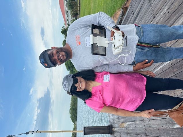
When Suchi Gopal heads to Belize, it’s not for the beaches by the azure Caribbean waters. She goes to document and map the mangrove forests. And Gopal, a Department of Earth & Environment professor, uses drones.
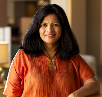
One of Gopal’s study spots is the resort area of Placencia, home to a diverse array of aquatic, amphibian, and avian wildlife, along with seaside swatches of the salt-tolerant mangroves, which provide a natural protective barrier and act as carbon-emission sponges. One hectare of mangroves can hold more than 440 metric tons of carbon, the Smithsonian’s Belize Blue Carbon project notes. Gopal’s research is part of a $20 million, seven-year National Science Foundation grant to engage local communities in finding ways to reduce climate risks with equitable, nature-based approaches.
To Gopal, who specializes in geospatial and geographic information systems (GIS), using images from satellites and drones along with other data to chart the location and condition of Belize’s mangroves exemplifies her field’s practical value. She’s working with other scientists on projects that can help communities in Belize and Indonesia to preserve native plant ecosystems threatened by expanding tourism infrastructure, urbanization, and coastal development.
“This grant brings together ecologists, civil engineers, social scientists, and data scientists—including spatial data scientists like me—to discuss sustainability and develop nature-based solutions,” Gopal says. “And it’s the convergence of all these sciences that leads, ultimately, to better solutions.”

Gopal, who joined the BU faculty in 1989, has made a career of building interdisciplinary connections. She maintains research affiliations with the BU Marine Program, the Pardee School of Global Studies, the Initiative on Cities, the Institute for Global Sustainability, the Rafik B. Hariri Institute for Computing and Computational Science & Engineering, and the Center for Remote Sensing. Gopal argues that her transcampus engagement is a natural outgrowth of her field of study. The science of location injects itself into every field. The power of place is everywhere.
She sees this idea come alive in the students who take her introduction to GIS undergraduate and graduate courses. “Those classes attract people from all walks of life, including the business school, public health, social work. They learn to think spatially,” she says.
Gopal says she wants students to understand the ramifications of GIS science and shares examples from her own work:

These multidisciplinary projects tackle real-world issues. “The science has to be practical. GIS mapping gives you a visualization tool to see it,” Gopal says. She adds that GIS practitioners can explore varied analytical techniques: describing what the data show; inferential analysis, using data samples to draw larger conclusions; predictive analysis, to project what is likely to occur; and prescriptive analysis that gives recommendations for the best actions.
“We can describe things using a map as a medium,” Gopal says. “We can do predictive analytics, making sure that we predict where the changes are going to happen based on what we know from the past or what we see as a pattern. And we can also prescribe action,” she says. Illuminating the locations and changes in carbon emissions can yield insights that lead to recommended actions in a metro area, whether that’s Boston or Vienna, Austria, she adds.
Gopal’s career combines a facility with statistical techniques with curiosity about conditions on the ground with a collaborative energy to engage other scientists and, most recently, citizens of the lands she studies. Her recent publication of The FinTech Revolution: Bridging Geospatial Data Science, AI, and Sustainability (Springer, 2024), with coauthor Josh Pitts (CAS`12), a technologist, explains how to use technologies like GIS, AI, and blockchain to guide decision-making on environmentally sustainable projects.
In Belize, the BU team and its partners are analyzing data from multiple types of imagery including satellites and at least two types of drone-flown cameras: multispectral cameras that record images in different light wavelengths and LIDAR (light detection and ranging) which uses light pulses to create precise three-dimensional images about the Earth’s surface.
“Collaborating with marine and coastal ecologists, local experts, and community leaders, we are developing tools to assess the ecological function and social value of mangroves across time and space,” Gopal says.
In this way, the mangrove forests represent a “nature-based solution” to climate change, where scientists collaborate with local communities. In Belize, the trees store carbon and prevent erosion and by incentivizing local communities to preserve them, the mangroves can remain—and even grow.

How can communities be incentivized, though? One option is to use the assets on a market like the European Union’s Emissions Trading System, where companies that emit carbon can purchase credits. If Gopal’s team succeeds, a future landowner in Belize could earn revenue for storing carbon on behalf of a polluter. A blockchain, acting as a digital ledger, could track these transactions securely and transparently, making it difficult to manipulate records—and easier to build trust among all the participants.
That is still in the future. As Gopal prepares for the next round of data collection with drones, supported by continuing NSF grants, she hopes that this project illustrates the value of scientists working in concert with people who can directly benefit from their work—such as the preservation of the rich diversity of mangroves and corals.
“Mangroves symbolize a broader lesson for society: that climate solutions rooted in nature can be both scientifically sound and socially just—but only if informed by the right data and governed through inclusive, equitable processes,” Gopal says. “This project reflects my broader research agenda, to harness the power of geospatial technologies for adaptive, resilient, and just environmental solutions. Whether through mapping health access or modeling climate risk, I aim to build tools that help society anticipate and adapt to change.”
Banner Image: A multispectral image taken by a drone over the coast of Central Java in Indonesia. Photo courtesy of Muhammad Helmi.