#BUandBoston: Raquel Jimenez works with Speak for the Trees in Boston
This post is part of our #BUandBoston series, highlighting the work and research of BU students, faculty, and staff throughout the City of Boston. Interested in having your Boston-related work featured? Tag us on Instagram or Twitter (@BUonCities) using the #BUandBoston or send us an email at ioc@bu.edu.
By Claudia Chiappa
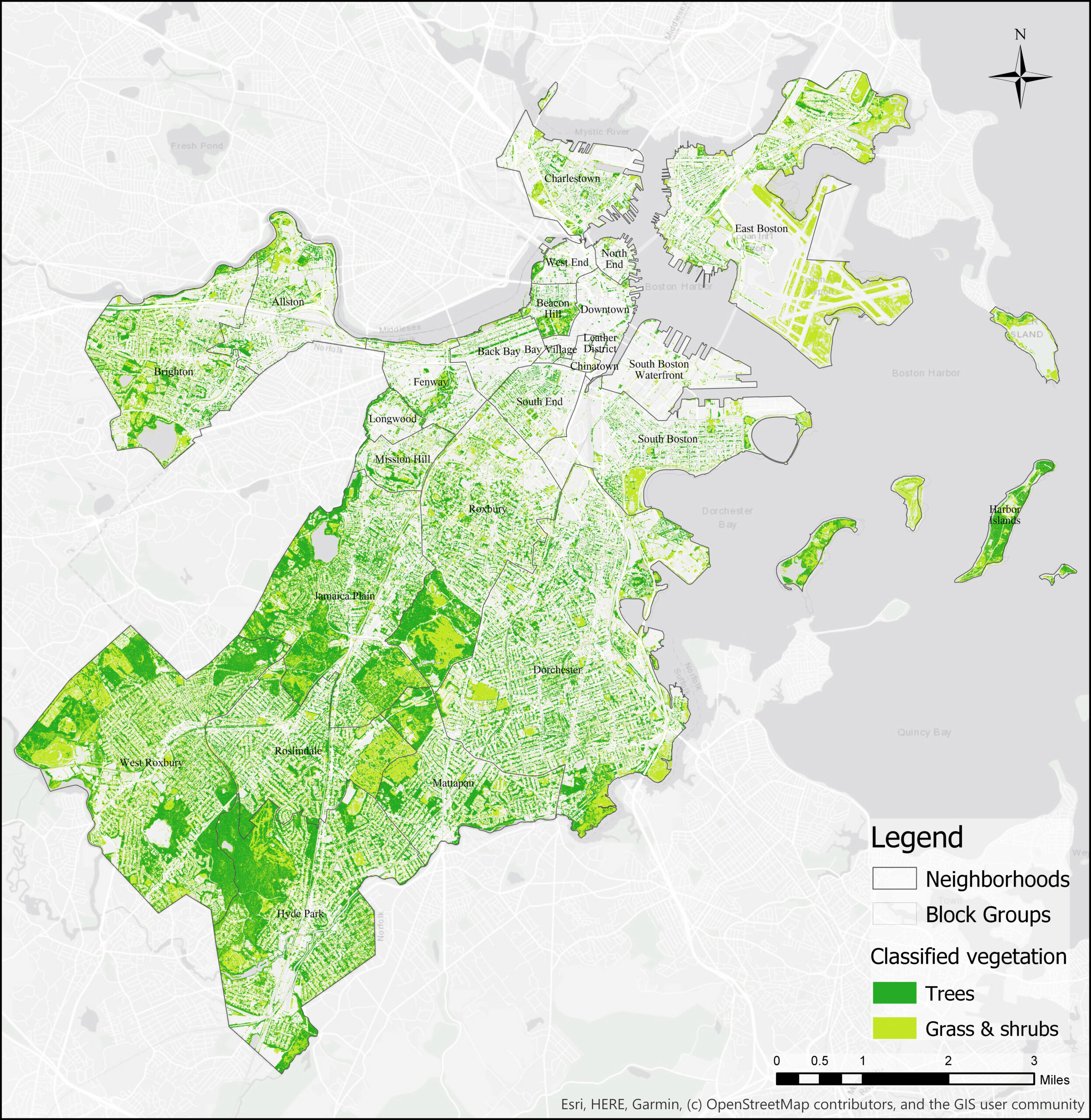
While Boston is often regarded as a green city, distribution of vegetation among neighborhoods is extremely unequal. A new interactive map put together by Boston University student Raquel Jimenez for Speak for the Trees shows the distribution of tree canopy in Boston and explores how it connects to the environment, to health, and to the demographics of each neighborhood.
“From research we know that trees provide tons of benefits for the environment, also improving the quality of life and the health of population,” said Jimenez.
Raquel Jimenez is a fifth year Environmental Health Ph.D. student in the BU School of Public Health. Originally from Chile, Jimenez studied environmental and industrial engineering before becoming interested in environmental health. An “environmentalist at heart,” Jimenez explained how she noticed that tying environmental issues to people’s wellbeing was the key to motivate them to take action.
“I realized at some point that connecting environmental issues to people’s health and well-being is a very important argument to make a case for the environment,” said Jimenez.
Her current work and dissertation examines how the presence of vegetation around schools benefits students’ learning and their health. She is also involved in the BU URBAN program, which helps PhD students in several field by training them and preparing them for life after school.
Through the URBAN program, Jimenez had the opportunity to work with Speak for the Trees, a local NGO which works to improve Boston’s tree canopy. It was during this internship that the idea for this project came to life.
The project started as a way for Speak for the Trees to determine what areas in Boston could benefit from more trees and vegetation. Jimenez initially worked like a researcher in her field would, downloading tons of data and analyzing it, but then the project evolved. While looking at vegetation distribution in neighborhoods and by observing the demographic of those communities, Jimenez noted that the idea of making maps available to the masses started to develop.
“This project took somewhat of a turn into another direction, into something that was more a community engagement and public communication project,” said Jimenez. “It was very fun going into this project with a very open mind and a very open plan. I feel like everything came into the right place. I love the final product.”
Jimenez said that she went into the internship with a” very scientific mindset, a very scientific perspective,” but as she worked on the project she realized this was not what the organization needed. She still created a database, but she realized the data was not the most useful product. It was about working with the NGO to figure out what the problem was and what the audience wanted.
“It was a challenge having to take a step back and move outside of my academic comfort zone and be better at listening and understanding, ‘what do they need from me? How can I put this scientific and research tools to their service?”
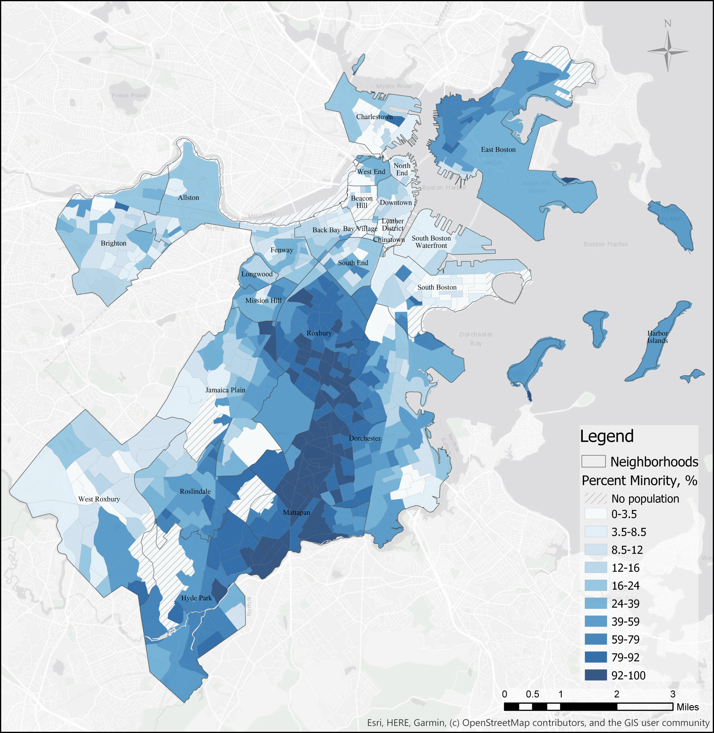
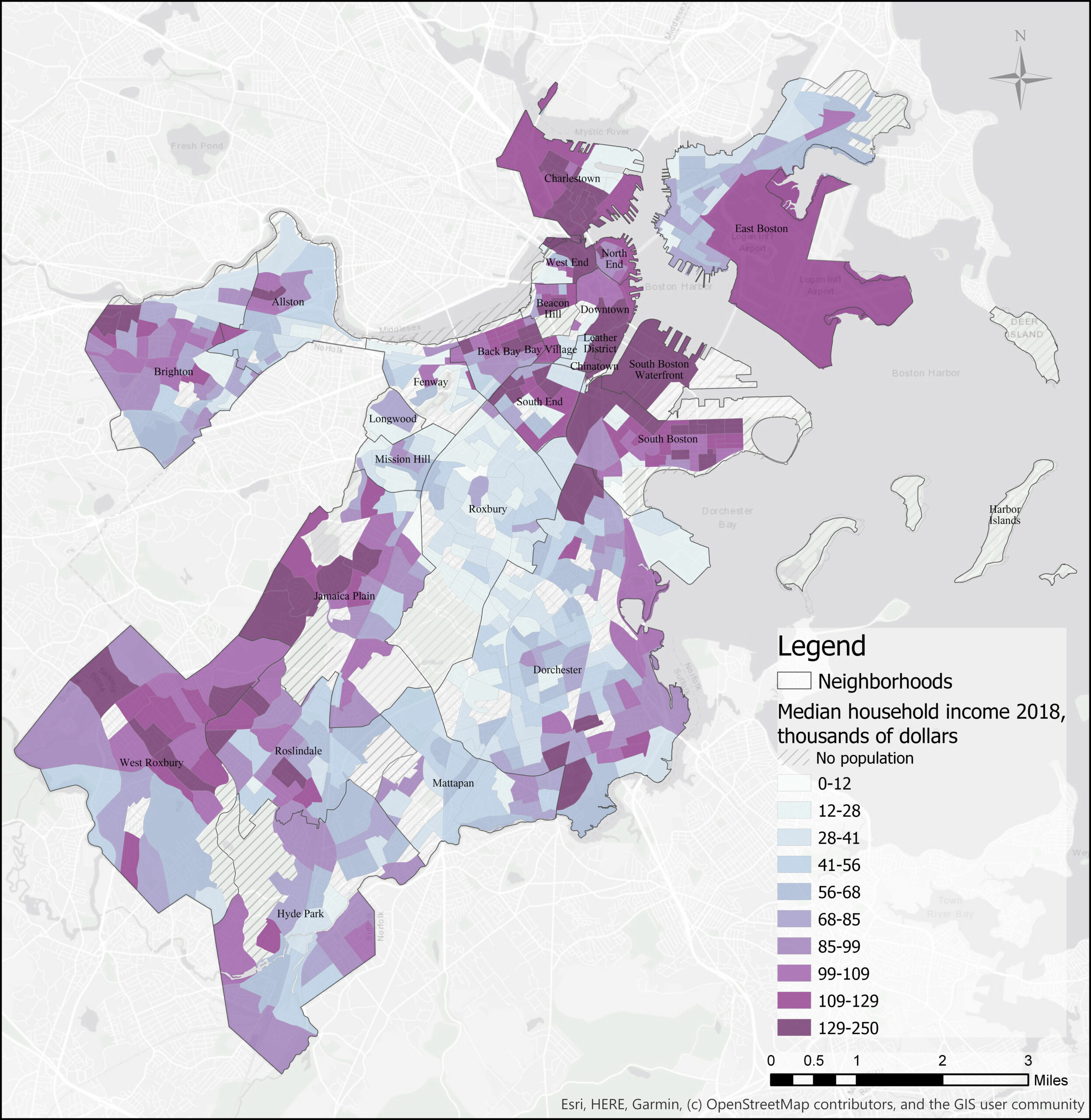
Jimenez explained how her research goes beyond looking at the distribution of trees and explores the social inequalities tied to uneven tree canopy.
“Those neighborhoods with higher proportions of ethnic and racial minorities, lower levels of education and lower income were the communities that had less trees,” said Jimenez. “These communities are already burdened by all these factors…and the fact that these communities have lower tree coverage compared to the wealthier or more advantaged communities is highlighting and further exacerbating these inequalities.”
The lack of trees in these communities is not simply affecting the environment, but also the people living in it.
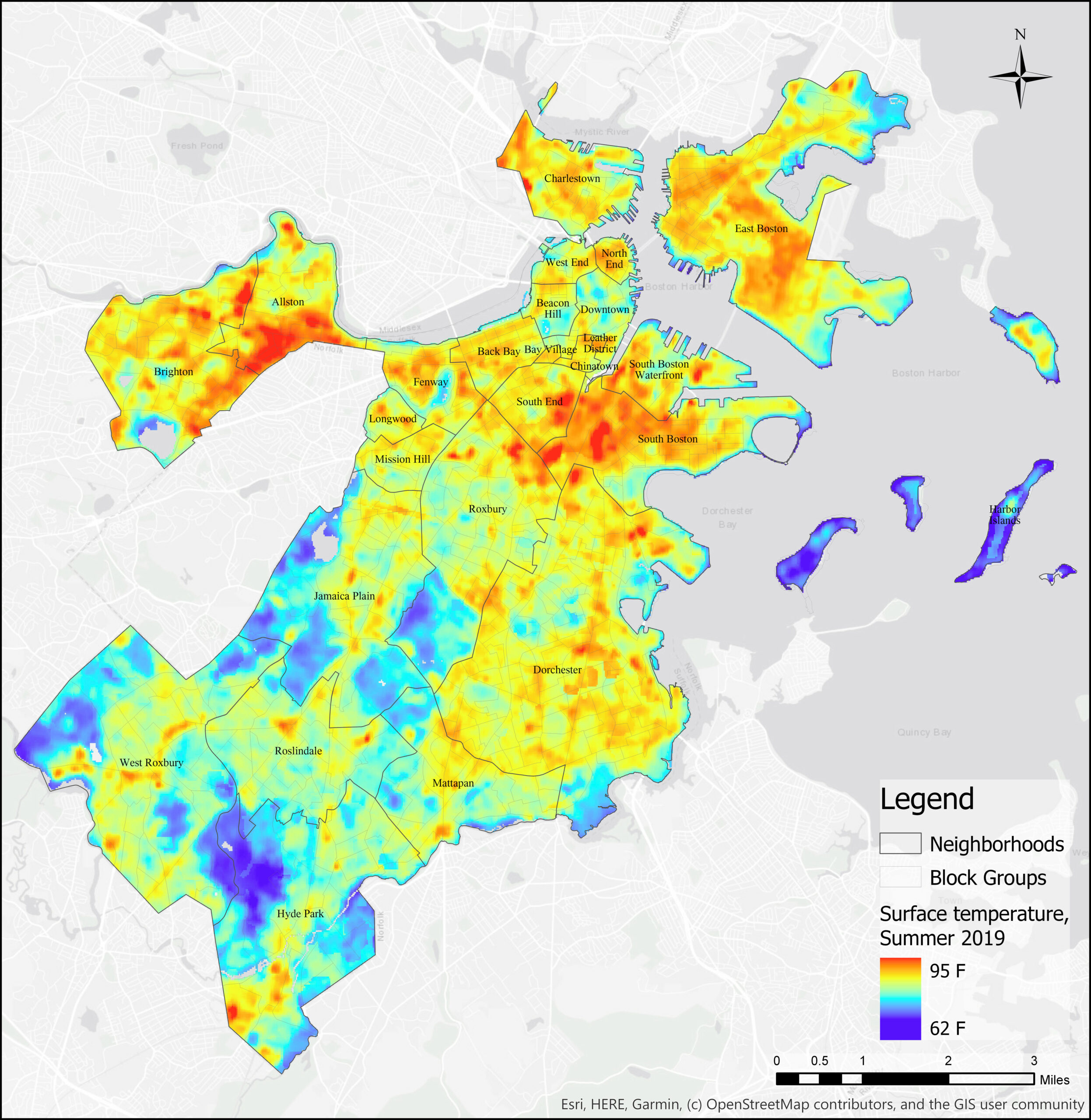
“Because in those same neighborhoods what you see is higher levels of air pollution, higher temperatures over the summer, less access to parks and open space for recreation, or they are less aesthetically pleasing,” noted Jimenez. “And all of those are risk factors that can really affect your health and your quality of life.”
According to Jimenez, another interesting element of her research was choosing to present the results through an interactive map. “What was a surprise for me was to learn and be more aware of the power of maps and mapmaking, and how maps can convey such a strong and clear message,” said Jimenez.
Jimenez explained how this project will help Speak for the Trees conduct outreach in environmental education, and implement tree planting campaigns with access to data that confirms which areas in Boston need more trees. Since the project makes it easier to clearly and visually see what neighborhoods need more trees, it can also become a useful tool for policymakers and the community.
Jimenez discussed how she would love to continue working on similar projects, eventually adding another layer showing the health outcome in the city and making the explicit connection between environmental inequalities and health issues. Jimenez said she is extremely proud of the work they produced, and she hopes it will help people see the “connection between vegetation and cities and the potential that they have to improve quality of life and environmental quality.”