Asia Maps: Digital Collections
Major digital collections of maps of Asia, regions within Asia, and individual countries can be found at the following selected sites. This list is certainly not exhaustive, and will be updated frequently – please send your comments and suggestions of additional useful Asia map sites to remurow@bu.edu.
Robert Murowchick
BU Center for the Study of Asia
Comprehensive Digital Map Collections:
 Originally a collaboration between Klokan Technologies GmbH, Switzerland and The Great Britain Historical GIS Project (University of Portsmouth, UK), this fantastic collection now indexes some 400,000 maps dating from 1550 to 2000 representing the collections contributed by 35 participating libraries and archives around the world. Searches can be undertaken by entering a term or by drawing a rectangle on a world map, with yields a list of relevant maps on the right side of the page. The individual maps are zoomable, although the quality of the resolution depends upon the nature of the scan provided by the source institution.
Europeana Collections
The superb Europeana website brings together the finest digital images from participating national libraries, archives, and museums across Europe, now totaling more than 53 million images. To find maps, in the initial search window enter the region or country of interest and “map”. A search for “China map”, for example, yields over 4,600 maps, images, and texts.
WWW Virtual Library: History of Cartography: Images of early maps on the web: 10. Asia
This site contains links to hundreds of online digital map collections, organized by country and region.
Collections with Maps | Library of Congress
 The Library of Congress holds the world’s most comprehensive map collection “…numbering over 5.5 million maps, 80,000 atlases, 6,000 reference works, over 500 globes and globe gores, 3,000 raised relief models, and a large number of cartographic materials in other formats, including over 19,000 cds/dvds.” A small but growing subset of this collection is available online in digital form. A search for particular regions or countries yields a list and thumbnail images of relevant holdings. The “Discovery and Exploration” collection holds a number of high-resolution maps of Asia from the 15th through 19th c.
David Rumsey Historical Map Collection
This collection, originally the private collection of David Rumsey and now housed at Stanford University, contains more than 150,000 maps and other cartographic items from the 16th through 21st centuries, with more than 1000 maps in its Asia collection. Individual maps are zoomable, and are of very high resolution.
Japanese Historical Maps Collection from the C. V. Starr East Asian Library: North and East Asia
The Japanese Historical Maps Collection contains roughly 2,300 manuscript, woodblock, and copperplate maps of Japan and the world, ranging in date from the seventeenth century into the modern era. The core of the collection came from the maps and atlases originally collected by Mitsui Takakata (Sōken) 三井高堅宗堅 (1867-1945), ninth head of the Shinmachi branch of the Mitsui clan. The East Asian Library acquired the collection as part of a larger acquisition from the clan in 1950. The collection also includes a small number of maps originally belonged to Motoori Bunko 本居文庫, the library of the well-known family of the Kokugaku scholars founded by Motoori Norinaga 本居宣長 (1730-1801) and succeeded in Wakayama by Motoori Ōhira 本居大平 (1756-1833), Uchitō 内遠 (1792-1855), and Toyokai 豊穎 (1834-1913), those collected by Mitsui Takatatsu (Sōshin) 三井高辰宗辰 (1845-1922) and Dohi Keizō (Gakken) 土肥慶蔵鶚軒 (1866-1931), as well as those of unknown provenance (including these, all those maps that were not originally listed in Sōken shoshū chizu mokuroku 宗堅所集地圖目録 compiled by Mitsui Bunko are marked with * after the call number).
A portion of the collection was digitized by David Rumsey and Cartography Associates and has been available for viewing at the Japanese Historical Maps website since 2003. More recently, with CLIR funding (2016) the remaining maps produced before 1923 were digitized and all these digitized maps have become available at the UC Berkeley Library Digital Collections. In addition, over 1,000 maps from the Japanese Historical Maps Collection are made available in Japanese Map Warper (you can view all those maps by searching “UCB” in Tags).
Other related collections include Single-sheet Print Collection = Ichimaizuri korekushon 一枚摺コレクション (688 items with over 1,000 images) and Copperplate Print Collection = Dōbanga korekushon 銅版画コレクション (ca. 2,400 images). For more information, see the Japanese Studies guide (“About the Collection”).
Perry-Castañeda Library Map Collection, University of Texas: Asia
The UT map collection in the Perry-Castañeda Library contains more than 250,000 maps, of which about 1/3 have been digitized and are available online. Searches are very straightforward in a cascading list Asiaàregionsàindividual countries. Selected historical, thematic, and topographic maps are included. Of particular interest are comprehensive collections of US AMS (Army Map Service) sheets.
Harvard Map Collection – Harvard College Library
The Harvard Library map collection is one of the largest and oldest collections in the US. Established in 1818, it now holds 400,000 maps, 6,000 atlases, and 5,000 reference books. A subset of these are now available in digital form at http://hcl.harvard.edu/libraries/maps/digitalmaps/.
Harvard-Yenching Library Digital Maps
Harvard-Yenching Library holds hundreds of maps of China, Japan, Korea, and other regions of East Asia. Many were published in the 19th and 20th centuries, but some can be dated to earlier periods. Over the years, scholars and visiting librarians worldwide have used these maps in their research. The maps are diverse in their function and format—some were created for administrative purposes, while others were made for military or commercial uses.
Digital Collections, University of Wisconsin-Milwaukee Libraries
A search for “map” yields over 9,000 scanned images; further refine your search with additional search terms (e.g. India map; Japan map)
American Geographical Society Library Digital Map Collection (University of Wisconsin-Milwaukee)
Excellent digital scans drawn from the American Geographical Society (AGS) map collection; browsable and searchable by country.
John Carter Brown Map Collection, Brown University
The John Carter Brown library at Brown University (Providence, RI USA) contains more than 13,000 items, including over 4,000 maps. The Asian collection provides high-resolution zoomable scans of over 300 maps dating between the early 16th c. and the late 19th c.
Asian Maps Collection, University of Southern California
 This USC collection focuses on East and Southeast Asia, with a particularly interesting Sea of Korea Collection of northeast Asian maps dating from 1601 to 1895.
Historical Maps of Asia, University of Alabama
Historical Maps of East Asia, University of Alabama
Organized chronologically, these digitized maps are viewable and zoomable but only in a relatively small window.
National Archief – National Archive of the Netherlands Kaartencollectie | Map Collection
Particularly strong collection of Southeast Asian maps of the Dutch colonial period.
National Library of Australia Map Collection
Norman B. Leventhal Map Center, Boston Public Library
Ryhiner collection: maps of the world – University of
Royal Geographical Society (RGS) Asia Collection
Newberry Library (Chicago) Maps, Travel, and Exploration Collection
Newberry Library (Chicago) Special Map Collections and Strengths
Osher Map Library, University of Southern Maine
Small but superb collection of world maps built around the core collections of Eleanor and Lawrence M.C. Smith, and Harold and Peggy Osher; includes about 50 high-resolution maps of Asia and individual countries from the 15th-19th centuries.
WWW Virtual Library: History of Cartography: Images of early maps on the web: East Asia
Antiquarian Map Vendors with important Asia collections:
A number of antiquarian map dealers also consistently maintain rich offerings of Asia-related maps viewable as high-resolution images. These include:
Paulus Swaen Map Auction and Galleries
The Map House of London
Geographicus Rare Antique Maps
Bergbook Rare Antique Maps
Murray Hudson Antique Maps, Globes, and Prints – China
Brian DeMambro Rare Books and Maps
Antique Print Room – Sydney :: MAPS World
Barry Lawrence Ruderman Antique Maps Inc.
Tooley Adams & Co. Antiquarian Maps and Atlases
Notable Collections of Asian Regions and Countries:
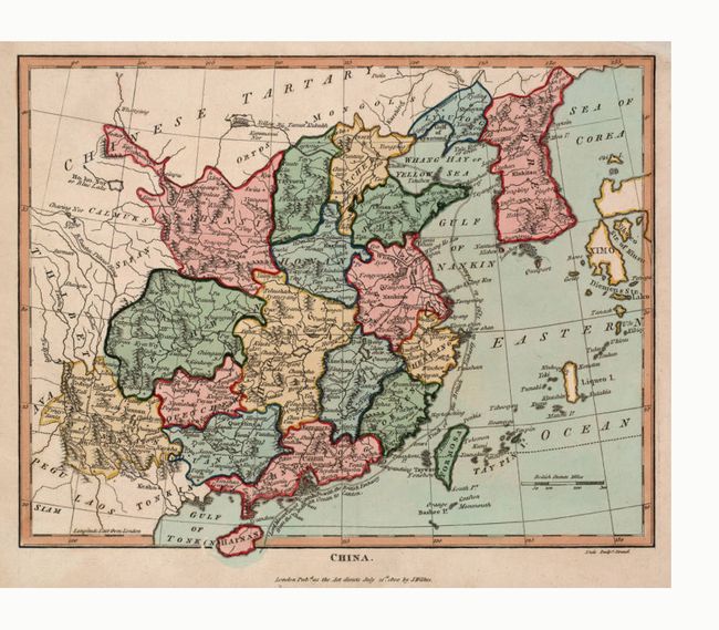
Maps of China
Maps of China in the Perry-Casteñeda Library, University of Texas
Maps of China in the David Rumsey Map Collection
Presents 540 high-resolution maps from the mid-16th through the 20th centuries.
Maps of China, Library of Congress
This site presents more than 400 scanned maps selected from the Library of Congress’s collection of more than 5,000 maps of China
Shanghai Maps Database (Virtual Shanghai), Osaka City University
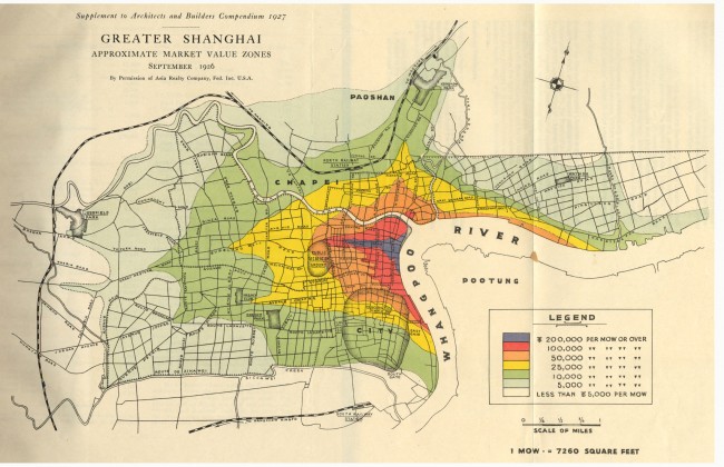 Straightforward collection of medium-resolution scans of nearly 800 maps of Shanghai from 1858 to 2008.
Several interesting Chinese blog sites provide maps of varying scan quality. Many surprises are to be found, as long as the pop-up ads don’t annoy you. The content is constantly changing as users upload additional materials. These blogs include:
Historical Maps of Nanjing 南京老地图
Historical Maps of SHANGHAI 上海老地图
Maps of Southeast Asia:
WWW Virtual Library: History of Cartography: Images of early maps on the web: Southeast Asia
Historical Maps of Southeast Asia, University of Alabama
Kaarten van de VOC (Maps of the Dutch East Indies Company) | GAHETNA
Carte Cambodge, Angkor, histoire, documents en ligne LEXILOGOS
Dutch Colonial maps in the collection of the Royal Tropical Institute, Leiden University Libraries
L’Indochine Coloniale – Plan et Cartes (Maps of French Colonial Indochina)
Maps of South Asia:
WWW Virtual Library: History of Cartography: Images of early maps on the web: South Asia
WWW Virtual Library: History of Cartography: Images of early maps on the web: Indian Ocean
Maps of South Asia, Columbia University Library
Historical Maps of South Asia before 1825, University of Alabama
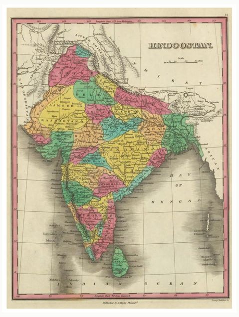
Maps from the Imperial Gazetteer of India (volumes 1-24)
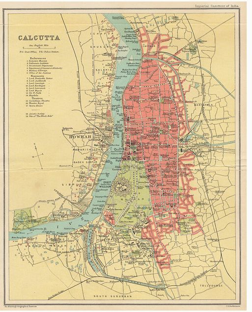 Provides high-resolution scans of the maps contained in the 24-volume Imperial Gazetteer, published in various editions between 1881 and 1931. The full text with detailed geographical, historical, ethnic, linguistic, economic, and administrative information can be found at http://dsal.uchicago.edu/reference/gazetteer/
India Maps, Perry-Castañeda Library Map Collection, University of Texas
Maps and Data, Survey of India (SOI)
Antique Maps of India, Map House of London
Antique Maps of India and Nepal
Antique Maps of India, Bergbook.com
Murray Hudson Antique Maps, Globes, and Prints — India
A huge collection, currently presenting more than 1,600 maps of India, downloadable as high-resolution images
Tibet Maps – From the Collections of the American Geographical Society Library (AGSL)
A Historical Atlas of South Asia, edited by Joseph E. Schwartzberg. Digital South Asia Library
India PlaceFinder (Mizushima Lab, University of Tokyo and Digital South Asia Library, University of Chicago)
A tool for finding geographic information about Indian place names.
Maps of Japan:
Japanese Historical Map Collection, David Rumsey Collection
The Japanese Historical Map Collection presents 1,900 digitized early maps of Japan from a collection of 2,300 early maps of Japan and the World acquired by the University of California from the Mitsui family in 1949. The collection is housed in UC-Berkeley’s C.V. Starr East Asian Library.
Japanese Historical Maps Collection from the C. V. Starr East Asian Library: North and East Asia
The Japanese Historical Maps Collection contains roughly 2,300 manuscript, woodblock, and copperplate maps of Japan and the world, ranging in date from the seventeenth century into the modern era. The core of the collection came from the maps and atlases originally collected by Mitsui Takakata (Sōken) 三井高堅宗堅 (1867-1945), ninth head of the Shinmachi branch of the Mitsui clan. The East Asian Library acquired the collection as part of a larger acquisition from the clan in 1950. The collection also includes a small number of maps originally belonged to Motoori Bunko 本居文庫, the library of the well-known family of the Kokugaku scholars founded by Motoori Norinaga 本居宣長 (1730-1801) and succeeded in Wakayama by Motoori Ōhira 本居大平 (1756-1833), Uchitō 内遠 (1792-1855), and Toyokai 豊穎 (1834-1913), those collected by Mitsui Takatatsu (Sōshin) 三井高辰宗辰 (1845-1922) and Dohi Keizō (Gakken) 土肥慶蔵鶚軒 (1866-1931), as well as those of unknown provenance (including these, all those maps that were not originally listed in Sōken shoshū chizu mokuroku 宗堅所集地圖目録 compiled by Mitsui Bunko are marked with * after the call number).
A portion of the collection was digitized by David Rumsey and Cartography Associates and has been available for viewing at the Japanese Historical Maps website since 2003. More recently, with CLIR funding (2016) the remaining maps produced before 1923 were digitized and all these digitized maps have become available at the UC Berkeley Library Digital Collections. In addition, over 1,000 maps from the Japanese Historical Maps Collection are made available in Japanese Map Warper (you can view all those maps by searching “UCB” in Tags).
Other related collections include Single-sheet Print Collection = Ichimaizuri korekushon 一枚摺コレクション (688 items with over 1,000 images) and Copperplate Print Collection = Dōbanga korekushon 銅版画コレクション (ca. 2,400 images). For more information, see the Japanese Studies guide (“About the Collection”).
Japan Maps in the Perry-Casteneda Library, University of Texas
Historical Maps of Japan (University of Alabama)
Tokyo Archive, Tokyo Metropolitan Library 「東京都立図書館・東京アーカイブ」
The Tokyo Archive specializes in materials related to Edo and Tokyo, and includes maps of pre-modern Tokyo.
Historical, Demographic and Economic Maps of Japan (G. William Skinner collection, University of Washington Libraries)
Gaihôzu: Japanese Military and Imperial Maps | Stanford University Libraries
 As its website states, “Stanford University Libraries holds a large collection of Japanese military and imperial maps, referred to as gaihozu, or “maps of outer lands.” These maps were produced starting in the early Meiji (1868-1912) era and the end of World War II by the Land Survey Department of the General Staff Headquarters, the former Japanese Army. The first charge was to map specific territories beyond Japan’s borders. Over time the mapping efforts grew to including “mapping of interimperial boundaries, cadastral surveys of the colonies, and detailed drawings of strategic cities and fortifications.” Geographically the Stanford maps cover a broad area including Japan, China, Mongolia, North Korea, South Korea, the Philippines, and beyond.”
Historical Maps of Japan
Includes links to hundreds of individual maps of Japan in other institutional collections or publications
Le Japon en cartes (Bibliothèque nationale de France)
The Maps and Plans department of the National Library of France was created in 1828 under the direction of Edme François Jomard (1777-1862), a former geographer who took part in Bonaparte’s Egyptian campaign. In France, this creation is contemporary with the development of geographic sciences and knowledge of the Earth. The collections were initially made up of catalogue records from the King’s Library and revolutionary seizures, such as those from the former Saint-Victor abbey in Paris. The increase in collections was fueled by the Legal Deposit of Cards and by an acquisitions policy led by successive directors. In the twentieth century, two important collections were added: the archives of the Marine Maps Depot, comprising more than 15,000 documents, and the collection of the Parisian geographer Jean Baptiste Bourguignon d’Anville comprising 10,500 documents, from the Ministry of Foreign Affairs.
Maps of Central Asia:
WWW Virtual Library: History of Cartography: Images of early maps on the web: Central Asia
Cyrillic Maps of East and Central Europe, Russia, Central Asia, Mongolia | Indiana University Libraries
An extensive collection of maps produced by Russia/the Soviet Union between 1890 and 1940
19th-Century Maps of the Middle East, North Africa, and Central Asia, University of Chicago Library
Selecting a polygon on a world map brings a list of relevant maps, each of which is viewable in very high resolution
Maps of Southwest Asia:
WWW Virtual Library: History of Cartography: Images of early maps on the web: Southwest Asia
19th-Century Maps of the Middle East, North Africa, and Central Asia, University of Chicago Library
Selecting a polygon on a world map brings a list of relevant maps, each of which is viewable in very high resolution
Some interesting thematic collections:
Gaihôzu: Japanese Military and Imperial Maps | Stanford University Libraries
As its website states, “Stanford University Libraries holds a large collection of Japanese military and imperial maps, referred to as gaihozu, or “maps of outer lands.” These maps were produced starting in the early Meiji (1868-1912) era and the end of World War II by the Land Survey Department of the General Staff Headquarters, the former Japanese Army. The first charge was to map specific territories beyond Japan’s borders. Over time the mapping efforts grew to including “mapping of interimperial boundaries, cadastral surveys of the colonies, and detailed drawings of strategic cities and fortifications.” Geographically the Stanford maps cover a broad area including Japan, China, Mongolia, North Korea, South Korea, the Philippines, and beyond.”
Asian Cities – Late 19th- and early 20th-century maps, University of Chicago Library 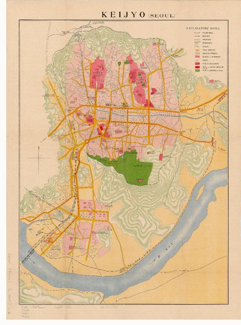 Map Collection
The library holds a large collection of Asian city maps, a selection of which are available online as 400 dpi scans.
Japan Earthquake and Tsunami maps in the Perry-Casteñeda Library, University of Texas
Soil maps of Asia. European Commission Joint Research Centre, European Soil Data Centre (ESDAC)
Historical Maps of Pacific Theatre in WWII
South China Sea territorial debate
 provides an interesting array of maps of the South China Sea published by different sources in 1937, 1939, 1946, 1947, 1951 and later. If you click on each individual map, you can download a very high resolution scan.
Geo-Spatial Digital Archive Project for Southeast Asia, Bangkok
If you or your students would like to test your knowledge of maps and geography, try out the following terrific self-quiz sites that challenge the user to test their map and geography skills. There are MANY options, ranging from pretty simple to ridiculously difficult. Give them a try!