Issue Archives
Bostonia is published in print three times a year and updated weekly on the web.
Summer 2018
Winter-Spring 2018

Fall 2017

Summer 2017
Winter-Spring 2017

Fall 2016
Summer 2016
Winter-Spring 2016
Fall 2015
Summer 2015

Winter-Spring 2015

Fall 2014
Summer 2014

Winter-Spring 2014

Fall 2013

Summer 2013

Winter-Spring 2013

Campaign 2012
Summer 2012

Winter-Spring 2012

Fall 2011
Summer 2011
Winter-Spring 2011

Fall 2010

Summer 2010

Winter-Spring 2010

Fall 2009

Summer 2009
Spring 2009

Winter 2009
Fall 2008
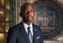
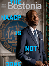
The NAACP Is Not Done
And new president Cornell William Brooks sees no reason to think that it will be done anytime soon

Take That!
CFA fight director makes stage bouts convincing—and safe
Lost
Who robbed the Gardner Museum?

Mapmaker / Matchmaker
Suchi Gopal and the power of maps

Special Report: Making Research Work
Exploring the challenges of academic research

U.S. News & World Report: SPH, ENG Biomedical Engineering in Top 10
Questrom School of Business, School of Law also rise
View All Stories View All Stories (Latest Issue)
close
Know What’s Good for Your Health? Artificial Intelligence
Data and algorithms can spot medical concerns early and point to solutions

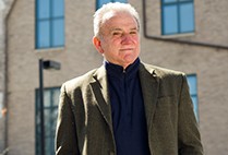
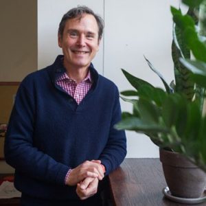
Crowdsourcing a Second Bill of Rights? ENG Professor Wants to Give It a Shot
Greg Blonder says our leaders often obstruct the public’s will

A Dead Humpback, a Team of Scientists, a Race for Answers
Did noise pollution in the ocean contribute to her death in the waters off Cape Cod? Her whale ears may hold important clues

Shari Davis (Sargent’10,’12) among 20 Obama Fellows Named Worldwide
“The Obamas represent…the reality that ceilings can and should be broken”

Natick’s World War II Museum Commemorates 75th Anniversary of D-Day
Founder Ken Rendell, who studied business at BU, has created special exhibition
Stan Sclaroff Named Dean of Arts & Sciences
After nationwide search, interim dean chosen for strong and consistent leadership

Related Stories
Putting Cities on the Climate Map
CAS researcher, undergrad UROP project tackle heat island problem
Connecting Students of Color
Launched and led by students, the Minority Connection Initiative seeks to foster community
Satellite Images Map Deforestation
Scientists use remote sensing to watch forests change
Post Your Comment