Center for Remote Sensing study probes new groundwater sources in Middle East
The global problem of water scarcity is growing, especially on the Middle East’s Arabian Peninsula, where there are no major rivers or lakes. In the past three decades, expanded urbanization and agricultural activity have placed substantial strains on water sources in the region.
Cordula Robinson is working on a research project that uses remote sensing data from satellite images to detect groundwater in the peninsula that is seeping into the Gulf of Oman. The associate research professor at the CAS/GRS Center for Remote Sensing is monitoring the appearance of several prominent plumes initially observed in thermal data from Landsat’s thematic mapper (TM) sensor and Terra’s advanced spaceborne thermal emission and reflection radiometer (ASTER).
“This water is exiting directly into the sea, not only on the land surface, but through fault lines in the solid rock,” Robinson says. “The plumes project from inland fracture zones, which have been mapped from optical images. We believe that the faults act as conduits to channel rainwater from the surrounding mountains and expel it into the gulf.”
High population growth, combined with increased per capita water consumption, is placing pressure on water resources in Bahrain, Kuwait, Qatar, Oman, the United Arab Emirates, Saudi Arabia, and Yemen. The population of these Arabian Peninsula countries has more than doubled since 1970 and is expected to double again, to 95 million, by 2025. A 2002 report by the United Nations Environment Program warns of severe water shortages in the Middle East over the next generation, especially in a zone running from the peninsula north through Syria and Iraq.
The plumes Robinson is studying could present a unique opportunity to harness fresh water. “Right now it’s going into the sea, so basically it’s lost water,” she says. “So once we’re able to certify the recurring appearance of short-term plumes after rainfall events, and long-term groundwater plumes, the next step is determining if anything can be done to trap and store the water. That’s the ultimate goal.”
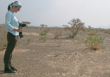
Robinson, pictured above in the Sharjah Desert Park in the United Arab Emirates, will present her research at the Geological Society of America’s annual meeting October 16 to 19 in Salt Lake City. Other researchers involved in the study are Artem Buynevich, a research assistant in the Center for Remote Sensing, Farouk El-Baz, a research professor and the center’s director, and Amin Shaban, a hydrogeologist for Lebanon’s National Council for Scientific Research.