Jerusalem in Time and Space: The Holy City in Maps
Period 1: Urushalimum--Jebusite/Pre-Israelite
Period 2: City of David--Seat of YHWH
First Temple Period/Judahite Kingdom (c1000-586BCE)
Second Temple Period (515BCE-70CE)
Satrapy Yehud: The Time of Nehemiah and Ezra (5th century BCE)
In the time of the Maccabeans (164-141BCE)
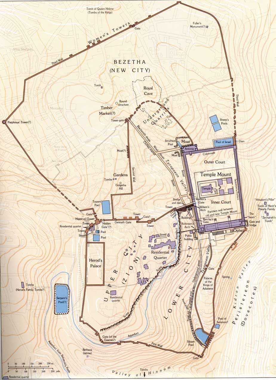
The City of Herod the Great (40-4BCE)
Herodian city with via dolorosa/sufferings of Christ (conjectural)
Period 3: Aelia-Symbol of Roman Power
Pagan City (135CE-324CE)
Christian/Byzantian City (324-638)
Period 4: Bayt al-maqdis of the caliphs (638-1099)
Period 5: Hierosolyma of the Latin Kingdom (1099-1187)
Period 6: Islamization of Jerusalem under the Ayyubids and Mamluks (1187-1517)
Period 7: Under the Ottomans (1517-1917)
Maps showing the urban development outside of the Old City between 1850 and 1914
Period 8: Under the British Mandate (1917-1948)
Period 9: UN-partition plan, war of independence and division (1947-1967)
Period 10: Modern City/Capital of the State of Israel (1967 to the present)
Territories occupied by Israel since 1967
Boundaries of Jerusalem municipality after June 1967 war
.jpg)
2.jpg)