| Navigation Across the Seas |
| Subject
Area |
Physics |
| Age
or Grade |
9th - 10th Grade |
| Estimated
Length |
50 minutes |
| Prerequisite
knowledge/skills |
Students will need to know about vectors and how to manipulate them. They will also need to know about trigonometric functions and the geometry of triangles. This material can be taught very simply by using graphics only or very challengingly by taking an analytic approach. I tried to find a happy medium between these two, but it depends on your students and their abilities. |
| Description
of New Content |
Students are introduced to nautical navigation. The students will learn how nautical charts are different from other types of maps/charts and why they are designed that way. They will learn and practice setting a course, taking a bearing and dead reckoning. |
| Goals |
Students will discover how vectors and other math/physics material is used in "real world" applications. People have been traveling by water for millennia, but they did not have mathematical sophistication. How did they do that? The student will learn. Now that we have mathematical tools, the students will learn how to apply them to solve the same problems (more accurately). |
| Materials
Needed |
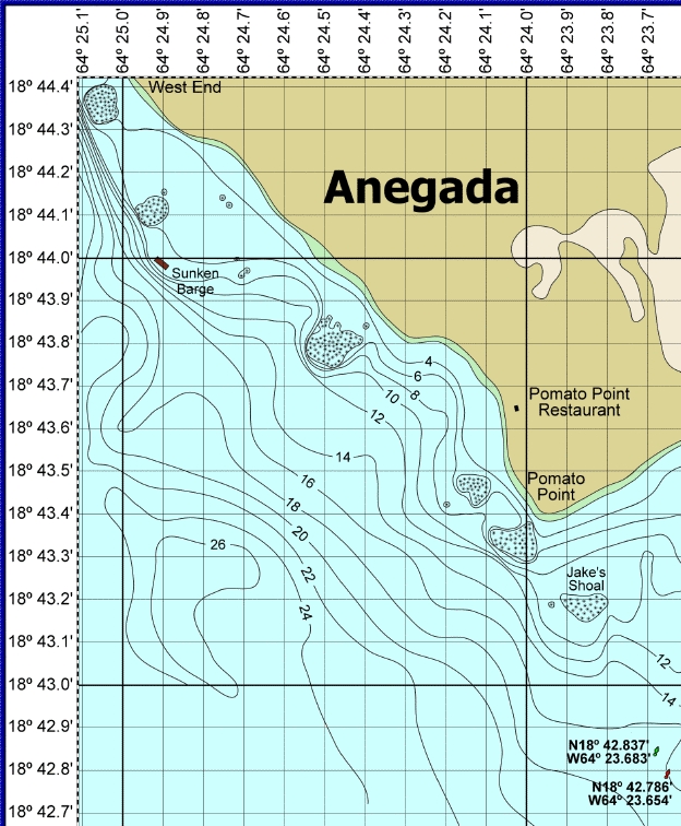
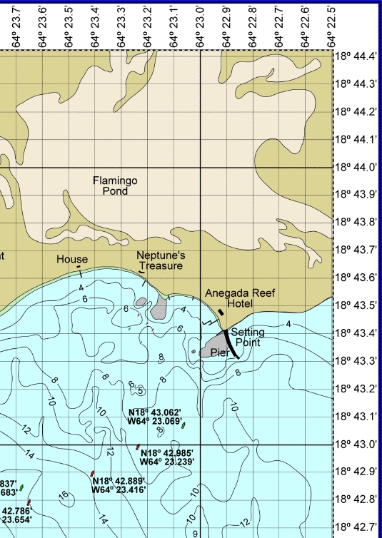
The students will need protractors, compasses, rulers and some example charts beyond the ones below and The MapQuest.com map of Charlestown, MA and Map Reading Activity. The accompanying Chart 1 and Chart 2 for Take Home Test. The accompanying Take Home Test Solutions. |
|
Procedure |
Opener: Bring out some nautical charts (from anywhere) and other types of maps (street, topographical, etc.) and ask the students to start identifying differences between them. Make sure that they notice the: compass rose, latitude and longitude lines, loran lines (if your chart has them), note to mariners and other features. Development: Explain how latitude and longitude are divided into degrees and then minutes. One minute is taken as 1 nautical mile (=1.16 regular miles) when located near the equator. Explain how the earth has a magnetic field and that the "magnetic" north pole is different from the "true" or actual north pole. The compass rose has both the "magnetic" and "true" compasses on it and that a compass on a boat uses the magnetic one. In practice, this can make a huge difference in where you end up traveling. Continue with an explanation of how vectors are used in estimating the actual direction of travel since it is the resultant vector of the boat's velocity, water current and other factors. All these velocity vectors add up in order to determine the actual velocity vector of travel. Show the students how the the directions on the compass measures angle differently than how math and physics measures angle. THIS IS IMPORTANT! Since the latitude and longitude lines are in the N-S and E-W directions, a protractor can be used to estimate the angle of a resultant vector. Everything can be estimated by utilizing a compass (the tool), a protractor, straight edge and parallel straight edge. For a more analytic and accurate approach, utilize properties of triangles and trigonometric functions. Closer: Close out with taking a bearing off landmarks and triangulating to determine a position. |
| Evaluation |
The homework and in-class participation. |
| Extensions |
Follow up with celestial navigation. |
| References | N/A |