![]()
Departments


![]()

|
Week of 30 April 1999 |
Vol. II, No. 33 |
Feature
Article
Satellite extends reach of effort to monitor global deforestation
By Hope Green
An endeavor by a Boston University research team to study forests from space shifted into high gear following the recent launch of NASA's Landsat 7 satellite.
Using data the spacecraft will collect as it circles Earth at an altitude of 438 miles, scientists at BU's Center for Remote Sensing (CRS) plan to develop and implement a global monitoring system for temperate conifer forests -- those regions where evergreen species such as spruce, pine, and redwood predominate.
The satellite was released into orbit on April 15. "The launch was successful, and the initial images and tests are all going extremely well," says Curtis Woodcock, the forest project's principal investigator and a CAS professor of geography.
After a testing period of about two months, instruments aboard Landsat 7 will begin collecting and archiving 250 images of Earth each day. Researchers around the world will use the images to study phenomena ranging from urban sprawl to changes in the Antarctic ice sheet.
Images captured by earlier Landsat satellites have enabled Woodcock and his colleagues to monitor the effects of drought on forests in California's Sierra Nevada. Scientists also have monitored clear-cutting in forests of the Pacific Northwest, based on a series of satellite images taken between 1984 and 1995.
Landsat 7, however, makes possible a comprehensive global monitoring program. The CRS team of faculty, research assistants, and graduate students will use its data to measure rates of forest destruction and regrowth throughout North America, Europe, and parts of Asia and South America.
Landsat images will be used in tandem with an instrument called the moderate-resolution imaging spectroradiometer (MODIS). That device will fly aboard the satellite Terra, which is scheduled for launch in July. Alan Strahler, CAS geography professor and chairman, and his research team will analyze MODIS data to identify large areas of significant changes in forest lands, and then Landsat 7 will home in on those areas to determine the nature and extent of the forest changes due to drought, clear-cutting, or fires.
|
|
|
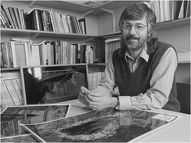
Curtis Woodcock, principal investigator for a satellite-based study on the health of temperate conifer forests, in his office with some images taken by an older-model spacecraft, Landsat 5. Photo by Kalman Zabarsky |
Nationwide, policy makers and scientists have used Landsat imagery for a range of applications, including land-use planning and mineral and petroleum exploration.
Woodcock entered the field of remote sensing (gathering data from space) in the late 1970s when he conducted a mapping project for the U. S. Forest Service. Keeping watch on the changing patterns of tree cover informs decision makers in protecting watershed areas and wildlife habitats as well as in maintaining a sustainable timber supply.
On a larger scale, studies show that forests have a significant effect on global climates. By consuming carbon dioxide, forests and other vegetation help to mitigate the buildup of greenhouse gases that contribute to global warming.
"For a long time, scientists have looked for ways to determine rates of deforestation in tropical regions," Woodcock says, "but little has been done to provide similar rates of deforestation in the United States. I found that embarrassing. That's why I became interested in using Landsat to look at the forests in temperate zones."
Landsat 7 represents a rejuvenation of the Landsat program, which began in 1972. After an initially successful era of Earth observation, the U.S. government commercialized the satellite program during the 1980s. The "crowning failure of commercialization," Woodcock says, was the failure of the launch of Landsat 6 approximately seven years ago. "As a result, we are still relying on data from Landsat 5, which was launched in 1985 and designed for a three-year mission. We have been extremely fortunate that it continues to work."
Under government management of the Landsat program, Woodcock says, each Landsat image will now cost $475, chopping the price from an astronomical $4,500 apiece.
The department of geography offers a number of courses on remote sensing, and students benefit from the opportunity to use many of the images that Woodcock and his colleagues collect for their research projects. A new introductory-level course, Environmental Science from Space, will be offered for the first time in the spring 2000 semester.
"Remote sensing has always been a strong part of our program for graduate students and juniors and seniors," Woodcock says. "The intent of the new course is to provide more students with an opportunity to understand the growing role of space-based observations in studying Earth."